Harlington Corner to Richmond
A moderate walk (city/town) starting and finishing in Greater London, England, about 13.00km (8.08 mi) long with an estimated walking time of about 3:45h. It is unsuitable for families with children, prams & pushchairs, wheelchairs.
Elevation Profile
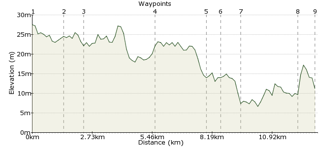
Ascent
5m (16ft)
Descent
21m (68ft)
Max. Elevation
30m (98ft)
Altitude Gain & Loss
26m (84ft)
Start
Harlington Corner
End
Richmond
Distance
13.00km
(8.08mi)
(8.08mi)
Duration
~3:45h
Difficulty
Moderate
Ordnance Survey Maps
A long walk in surburbia passing through some surprisingly tranquil areas amidst the cityscape. The walk gives some unusual views of Heathrow. We visit the former Hounslow Heath airfield and a terrific pub. The walk ends in the picturesque suburb of Richmond.
Walk Functions
Share
Nearby Walks
Stanwell to Sheperton
A moderate, linear walk (riverside) starting in Surrey, England, about 11.50km (7.15 mi) long, duration: ~3:15h.Osterley Park to Brentford
A leisurely, linear walk (canal) starting in Greater London, England, about 7.00km (4.35 mi) long, duration: ~1:45h.Iver To Staines
A moderate, linear walk (riverside) starting in Buckinghamshire, England, about 13.90km (8.64 mi) long, duration: ~4:00h.Walk Map
- $walk->POI array(0)
Waypoints
OS Grid TQ088769
Situated on the North eastern side of Heathrow, Harlington Corner is best accessed from Hayes and Harlington station by catching a 140 bus. Many other bus routes from other origins also converge here.
From Harlington Corner continue in a westerly direction until you reach Cranford. Turn right into Waye Avenue and then bear right at the fork.
OS Grid TQ102764
At the end of Waye Avenue continue ahead on the Crane Valley path. At the A30 cross carefully and then continue on the path on the other side.
About 1.45 km (~0.9 miles) from 
OS Grid TQ105757
Continue along the path passing under The Causeway and across Staines Road. Follow the Crane Valley Path for a while and then cross a bridge and follow the London Loop signs across Hounslow Heath. When you arrive at Hanworth Road, turn right. Pass under the railway bridge and then, after Elliman Avenue on the right, turn right back onto the Crane path.
About 0.81 km (~0.5 miles) from 
OS Grid TQ124731
Continue alongside the Crane River, firstly on the London Loop and then, after the Loop turns right, continue alongside the Crane River.
About 3.23 km (~2.01 miles) from 
OS Grid TQ147732
At the Community Centre on Meadway leave the river and turn right onto Meadway.At the end turn left then right into Second Cross Road and visit the Sussex Arms, a pub selling ten real ales.
About 2.28 km (~1.42 miles) from 
OS Grid TQ151728
Upon leaving the pub continue to the end of Second Cross Road, turn left then right into Walpole Road. At its end turn left into Wellesley Road. Continue past Strawberry Hill station into Tower Road. At the end of Tower Road cross into Radnor Gardens.
About 0.56 km (~0.35 miles) from 
OS Grid TQ160724
Turn left here onto the Thames Path and follow the path all the way through to Richmond.
About 0.99 km (~0.62 miles) from 
OS Grid TQ177744
At Richmond Bridge cross over the river and follow the signs to Richmond Station.
About 2.58 km (~1.6 miles) from 
 Richmond Station.
OS Grid TQ180751
Walk finishes here. Catch your train.
About 0.79 km (~0.49 miles) from 

1 comment... join the discussion!
Mark S
bus routes from other origins also converge here. From Harlington Corner continue in a westerly direction until you reach Cranford. Turn right into Waye Avenue and then bear right at the fork. Surely the direction is easterly, towards London from Harlimgton Corner