A day of dales
A moderate walk (countryside) in national park Peak District in Derbyshire, England, about 17.20km (10.69 mi) long with an estimated walking time of about 5:30h. It is unsuitable for families with children, prams & pushchairs, wheelchairs.
Elevation Profile
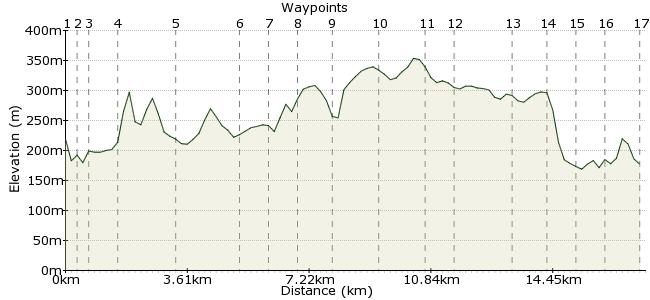
Ascent
222m (728ft)
Descent
264m (866ft)
Max. Elevation
360m (1181ft)
Altitude Gain & Loss
486m (1594ft)
Start & End
Monsal Head
Distance
17.20km
(10.69mi)
(10.69mi)
Duration
~5:30h
Difficulty
Moderate
Ordnance Survey Map
This walk in the Peak District takes in several dales between Monsal Head and Blackwell, including Upperdale, Miller's Dale, Chee Dale, Wye Dale and Monsal Dale. The route passes through some old tunnels on the Monsal Trail as well as passing over the impressive Headstone Viaduct.
Good bus connections from Bakewell and Castleton.
Walk Functions
Share
Nearby Walks
Walking in the White Peak
A moderate, circular walk (countryside) starting in Derbyshire, England, about 13.70km (8.51 mi) long, duration: ~4:30h.Bakewell to Haddon Hall and back
A leisurely, circular walk (countryside) starting in Derbyshire, England, about 8.60km (5.34 mi) long, duration: ~2:45h.Baslow to Bakewell via Chatsworth
A leisurely, linear walk (countryside) starting in Derbyshire, England, about 8.20km (5.10 mi) long, duration: ~2:45h.Walk Map
- $walk->POI array(0)
Waypoints
OS Grid SK184715
Take the bus to Little Longstone, near Monsal Head.
OS Grid SK182718
Take the road heading to Upperdale and cross the river at the first bridge you reach.
About 0.37 km (~0.23 miles) from 
OS Grid SK179718
The footpath joins the Monsal Trail: www.peakdistrict.gov.uk/visiting/cycle/monsaltrail
About 0.29 km (~0.18 miles) from 
OS Grid SK171724
The path heads through Cressbrook and Litton tunnels, two old tunnels that were reopened in 2011.
About 0.94 km (~0.58 miles) from 
OS Grid SK157729
At Litton Mill, rejoin the riverside footpath, passing through the woods.
About 1.52 km (~0.94 miles) from 
OS Grid SK138732
Cross the river again at the footbridge at Miller's Dale, then turn left to follow the footpath through the woods.
About 1.89 km (~1.17 miles) from 
OS Grid SK130734
Stay on the path on the northern side of the river, heading around the meander to Chee Dale.
About 0.85 km (~0.53 miles) from 
OS Grid SK122732
Head around to Chee Tor, crossing the stepping stones if the river allows!
About 0.80 km (~0.5 miles) from 
OS Grid SK112727
Continue along the footpath to the head of Wye Dale. Cross the river again here and head southeast along the bridleway.
About 1.09 km (~0.68 miles) from 
OS Grid SK122720
The bridleway takes you to Blackwell. Join the road through the village.
About 1.22 km (~0.76 miles) from 
OS Grid SK137716
Pass through Priestcliffe Ditch to Rock Lodge Farm. Follow the footpath heading northeast from the farm, where it soon joins a track.
About 1.48 km (~0.92 miles) from 
OS Grid SK142721
At the end of the track, the path splits; take the fork heading across the fields to High Dale.
About 0.73 km (~0.45 miles) from 
OS Grid SK159715
Continue along the path through High Dale to Brushfield.
About 1.80 km (~1.12 miles) from 
OS Grid SK168716
At the path junction, you can either head straight to Monsal Head or walk south into Monsal Dale to return via the riverside.
About 0.89 km (~0.55 miles) from 
OS Grid SK170707
The path drops steeply through the woods before a hairpin turn takes you back along the river.
About 0.92 km (~0.57 miles) from 
OS Grid SK171714
The final stretch is possibly the finest bit of the whole route.
About 0.73 km (~0.45 miles) from 
 Viaduct
OS Grid SK182715
Continue along the Headstone Viaduct to return to Little Longstone. Hopefully there's time for a pint in the Packhorse Inn before catching the bus homewards: www.packhorselongstone.co.uk
About 1.08 km (~0.67 miles) from 
