The Hughenden Estate
A moderate walk (countryside) starting and finishing in Buckinghamshire, England, about 11.70km (7.27 mi) long with an estimated walking time of about 3:45h. It is unsuitable for families with children, prams & pushchairs, wheelchairs.
Elevation Profile
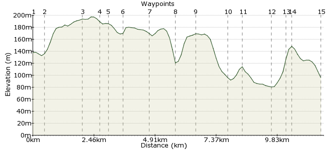
Ascent
203m (666ft)
Descent
245m (803ft)
Max. Elevation
200m (656ft)
Altitude Gain & Loss
448m (1469ft)
Start
Great Missenden
End
High Wycombe
Distance
11.70km
(7.27mi)
(7.27mi)
Duration
~3:45h
Difficulty
Moderate
Ordnance Survey Maps
This walk passes through some typically enjoyable Chilterns scenery. The first half of the walk is dominated by small patches of beech woodland. The second part passes through the Hughenden Valley and estate, managed by the National Trust (www.nationaltrust.org.uk/hughenden).
There are a few road crossings, inevitable being this close to the capital and in the commuter heartland of the Home Counties. But beyond these, the walk is blissfully rural.
I found this walk in 'Walks in the Country near London' by Christopher Somerville. An essential purchase for any south-east car-free walkers.
One thing to note; if you are coming from London, the stations are on different lines. Ask at the ticket office for the cheapest travel option, and if there is a day return that allows you to travel back from High Wycombe. There are also buses between the two towns.
Walk Functions
Share
Nearby Walks
The Chesham Outer Ring
A leisurely, circular walk (countryside) starting in Buckinghamshire, England, about 9.90km (6.15 mi) long, duration: ~3:00h.Quick hour walking about on Coombe Hill
A leisurely, circular walk (low hills and fells (below 600m)) starting in Buckinghamshire, England, about 5.10km (3.17 mi) long, duration: ~1:45h.Berkhamsted Common
A leisurely, circular walk (woodland) starting in Hertfordshire, England, about 7.00km (4.35 mi) long, duration: ~2:15h.Walk Map
- $walk->POI array(0)
Waypoints
OS Grid SP892013
Start the walk at Great Missenden. Turn left onto Station Approach, then left again into Trafford Road.
OS Grid SP893009
At the end of Trafford Road, head southwest towards the woods.
About 0.41 km (~0.25 miles) from 
OS Grid SP880001
Pass through the woods and then cross the road just south of Prestwood.
About 1.53 km (~0.95 miles) from 
OS Grid SU878995
Continue through the next patch of woodland, Peterley Wood. At the start, take the left fork (the footpath) rather than the bridleway.
About 0.66 km (~0.41 miles) from 
OS Grid SU875994
Cross the main road by the Polecat Inn, then take the footpath directly opposite.
About 0.27 km (~0.17 miles) from 
OS Grid SU871990
Cross another road to enter Longfield Wood.
About 0.59 km (~0.37 miles) from 
OS Grid SU869979
At the southern end of Longfield Wood, you need to double back along the road for a short distance. Continue until you reach the footpath on your left.
About 1.07 km (~0.66 miles) from 
OS Grid SU866970
The path continues due south through another mixed woodland. At Boss Lane Farm, take the path going straight ahead, which leads to the road.
About 0.97 km (~0.6 miles) from 
OS Grid SU873968
Cross carefully to enter the Hughenden Valley.
About 0.71 km (~0.44 miles) from 
OS Grid SU867957
The walk opens out here, as you head down into the lovely Hughenden Valley. Pass the barn and keep heading south. Just beyond it you reach a junction with a bridleway; turn right here.
About 1.24 km (~0.77 miles) from 
OS Grid SU862955
The walk now enters the Hughenden Estate, managed by the National Trust. Former prime minister Benjamin Disraeli lived here, back in the day.
About 0.54 km (~0.34 miles) from 
OS Grid SU864943
Continue south through the estate and you reach the edge of High Wycombe.
About 1.20 km (~0.75 miles) from 
OS Grid SU869944
Instead of heading straight for the town centre, cross the Hughenden road and walk along Green Hill.
About 0.53 km (~0.33 miles) from 
OS Grid SU870943
Turn right at the end, then right again to reach Ridge Way. Here, look for the footpath sign that leads to an old track that heads into town. Known as the Greenway, it's a nicer finish that along the main road.
About 0.16 km (~0.1 miles) from 
 Station
OS Grid SU867932
The Greenway takes you right into town, with the station just nearby.
About 1.18 km (~0.73 miles) from 
