Richmond & St. Margarets Loop
A leisurely walk (riverside) in City of London, England, about 6.70km (4.16 mi) long with an estimated walking time of about 1:30h. It is suitable for families with children, but unsuitable for prams & pushchairs, wheelchairs.
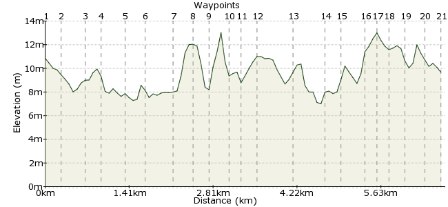
Elevation Profile
Ascent
17m (55ft)
Descent
18m (59ft)
Max. Elevation
20m (65ft)
Altitude Gain & Loss
35m (114ft)
Start & End
St. Margarets train station
Distance
6.70km
(4.16mi)
(4.16mi)
Duration
~1:30h
Difficulty
Leisurely
Ordnance Survey Map
 3Created by John Walker on 01 Jul 2014
This walk starts and ends at St. Margarets train station, 20 minutes from Clapham Junction. The route is almost entirely on the level, on tarmac surfaces, much of it along the riverbank. It takes in a section of the Thames Path and a brief stretch of the Capital Ring. The walk passes some historic houses and there are lots of refreshment stops available.
Walk Functions
Share
Nearby Walks
Marble Hill to Bushy Park
A moderate, linear walk (riverside) starting in City of London, England, about 12.20km (7.58 mi) long, duration: ~3:30h.The River Crane walk
A leisurely, linear walk (riverside) starting in Surrey, England, about 4.40km (2.73 mi) long, duration: ~1:15h.Twickenham to Putney
A moderate, linear walk (riverside) starting in Surrey, England, about 12.20km (7.58 mi) long, duration: ~3:30h.Walk Map
- $walk->POI array(0)
Waypoints
OS Grid TQ168742
Cross the main road outside the station and turn right, passing on the left the ugly clutter of buildings that is Twickenham Studios, still active and responsible for many past iconic films including ‘The Italian Job’, the Beatles’ films and ‘Blade Runner’.
OS Grid TQ170741
Take the third left, Rosslyn Rd., then left again into Arlington Rd., finally bearing left into Arlington Close.
About 0.22 km (~0.14 miles) from 
OS Grid TQ170745
At the end of this Close a footpath goes ahead, alongside a railway line, emerging onto the towpath of the Thames.
About 0.39 km (~0.24 miles) from 
OS Grid TQ172747
Turn left and follow the towpath under a railway bridge and then under Twickenham Bridge, continuing beside the river to Richmond Lock.
About 0.21 km (~0.13 miles) from 
OS Grid TQ169749
This 19th century structure is a tidal lock, its Victorian mechanism still in use, which can be raised or lowered to control the river level above it. Climb the footbridge over the lock and turn right along the opposite towpath towards Richmond town centre. The path borders Old Deer Park and behind you, on the edge of the park is historic Kew Observatory, in a golf course adjacent to Kew Gardens. The obelisk in Old Deer Park, one of three still remaining, was used for aligning the observatory’s telescopes along a meridian.
About 0.35 km (~0.22 miles) from 
OS Grid TQ171749
Walk back under the same two bridges before passing Asgill House (with a famous tree in its garden). This restored 18th century house is built on part of the site of Richmond Palace, built by Henry VII from 1501.
About 0.23 km (~0.14 miles) from 
OS Grid TQ175747
Take the next road on the left up Friars Lane, past a car park, following along the border of the site of Richmond Palace, to emerge onto Richmond Green.
About 0.44 km (~0.27 miles) from 
OS Grid TQ176748
Turn left along the edge of the green and after 50 metres, you see to your left the Gate House, one of the few surviving structures of the Palace. The large open space of the Green has a cricket pitch in the middle and is surrounded by grand private houses as well as Richmond Theatre but is noisily over flown by the flight path into Heathrow airport. This is a good place for a refreshment stop at any of several pubs and cafes within sight of the Green.
About 0.21 km (~0.13 miles) from 
OS Grid TQ176746
When you've had enough of the pubs or the planes return to the river bank and continue past the popular but disneyesque Richmond Riverside development, passing under one archway of Richmond Bridge (the oldest surviving Thames bridge in London). An adjacent archway houses Tide Tables cafe.
About 0.23 km (~0.14 miles) from 
OS Grid TQ177745
Just on the other side of the bridge turn left up steps towards the memorial to Bernardo O'Higgins. He was at school in Richmond and later became a leading nationalist in Chile’s struggle for independence from Spain. Turn left and then left again to take the road across the bridge.
About 0.21 km (~0.13 miles) from 
OS Grid TQ176744
Don't miss the stone steps on the far side of the river leading down to a slipway. Go right to take the towpath heading up river. At high tide you may have to go beyond the steps to join the path. Watch out for parked cars inundated on the slipway. Although there are warnings clearly displayed the river level rises very fast and catches out many car drivers, much to the entertainment of the locals.
About 0.15 km (~0.09 miles) from 
OS Grid TQ178742
Ahead are excellent views across Petersham Meadow (home to an urban herd of cows) and to the left Richmond Hill and Park rise up on a river terrace. The large brick building on-top of the hill is the former Star and Garter home for wounded veterans, now waiting to be turned into a hotel. The view from Richmond Hill along the Thames is protected against suburban development and encroachment by an act of parliament passed in 1902.
About 0.25 km (~0.16 miles) from 
OS Grid TQ178737
Just past the still uninhabited Glover's Island is one small piece of residential development, a 'house raft', a collection of homemade floating islands on which a local man has lived for several decades. His empire includes floating duck ponds and small gardens.
About 0.53 km (~0.33 miles) from 
OS Grid TQ174734
On the opposite bank notice the seventeenth century Ham House, now belonging to the National Trust. On the Twickenham bank your path passes a small white gem of a house, a ’Palladian villa’. This is Marble Hill House, set in its own park, originally built in the 1720’s and lived in by Henrietta Howard, Countess of Suffolk, the mistress of King George II. Our route will loop back around the house later.
About 0.47 km (~0.29 miles) from 
OS Grid TQ172733
Remain on the towpath as you pass Hammerton's Ferry, still running daily in summer and at weekends in winter, which takes foot passengers, dogs and bikes across to Ham House and the Thames towpath on the other side, going upriver to Ham and Kingston.
About 0.21 km (~0.13 miles) from 
OS Grid TQ169732
Shortly the path leaves the river bank to meet a road. Cross directly and go through a gate into the grounds of Orleans Gallery. The brick-built building ahead of you belongs to the local council and is all that remains of a much larger house, another Palladian villa, demolished in 1926, prior to digging gravel from this site. The plan was stopped but only the Octagon Room and a small wing of the house were saved. The surviving building is used for art exhibitions. Behind it are the former stables, a space used for art and craft activities, also housing toilets and an excellent cafe, Karmarama.
About 0.32 km (~0.2 miles) from 
OS Grid TQ169734
Next to the cafe entrance turn right on a path through woods which reaches a wrought iron gate in a wall.
About 0.16 km (~0.1 miles) from 
OS Grid TQ170735
Emerge carefully onto a road, turning left to walk about 50 metres before turning right into Marble Hill Park, with yet another nice cafe in the stable block on your left. Straight ahead is the white house which also has an interesting ice house nearby and a restored 'grotto' behind it. The house belongs to English Heritage and is open to visitors mainly at weekends in summer.
About 0.18 km (~0.11 miles) from 
OS Grid TQ173736
Walk past the front of the house to reach another path at right angles, turn left and continue to the park exit.
About 0.29 km (~0.18 miles) from 
OS Grid TQ172739
From here cross into Sandycombe Road an old suburban street running the gamut of Victorian house styles, from small terraced workers’ cottages to large villas for the middle classes. Just before a T-junction there is a largish white house on the right, almost overgrown by yew trees and looking slightly neglected. This was the home, dating from 1813, designed and lived in by JWM Turner. It is open to the public irregularly and restoration is underway.
About 0.27 km (~0.17 miles) from 
 St, Margarets station
OS Grid TQ170741
At the T-junction with St. Margarets Rd. turn left and walk another 300 metres to return to the train station.
About 0.27 km (~0.17 miles) from 
