Lynton & Lynmouth
A leisurely walk (coast) in national park Exmoor in Devon, England, about 5.70km (3.54 mi) long with an estimated walking time of about 2:15h. It is suitable for families with children, but unsuitable for prams & pushchairs, wheelchairs.
Elevation Profile
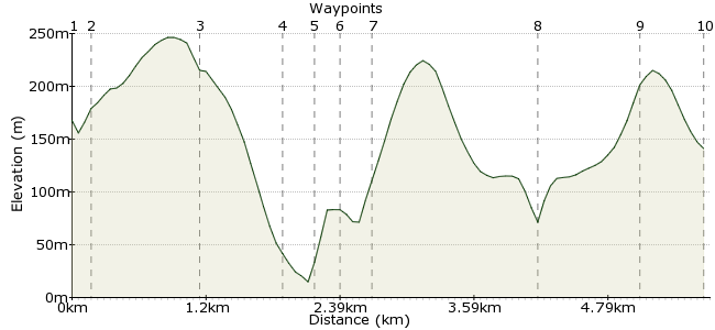
Ascent
256m (839ft)
Descent
283m (928ft)
Max. Elevation
250m (820ft)
Altitude Gain & Loss
539m (1767ft)
Start & End
Lynbridge
Distance
5.70km
(3.54mi)
(3.54mi)
Duration
~2:15h
Difficulty
Leisurely
Ordnance Survey Map
This walk explores the many attractions around the villages of Lynton and Lynmouth on the Exmoor coast. There's plenty to see and do, so although the distance isn't huge, allow a full day to give the region a proper visit. Some of the sections are quite steep up and down to Lynmouth; there are buses from the village if you want to avoid the steep climbs. Likewise, some bits along the Westway have a very steep drop without a barrier so keep an eye on kids.
Walk Functions
Share
Nearby Walks
The moors of Exmoor
A strenuous, circular walk (moorland) starting in Devon, England, about 20.00km (12.43 mi) long, duration: ~7:15h.Exmoor's extraordinary coastline Part II
A moderate, linear walk (coast) starting in Devon, England, about 18.10km (11.25 mi) long, duration: ~7:15h.Cosgate Hill to Countisbury
A moderate, circular walk (coast) starting in Devon, England, about 12.40km (7.71 mi) long, duration: ~4:30h.Walk Map
- $walk->POI array(0)
Waypoints
OS Grid SS719485
If coming from the south, ask the bus driver to drop you at Lynbridge, where there is a small tourist information office.
OS Grid SS720485
Drop down to the river and cross via the bridge. The riverside path runs on the opposite bank.
About 0.15 km (~0.09 miles) from 
OS Grid SS728489
The path winds through this beautiful woodland to Lyn Cleave, then pick up the Two Moors Way heading downhill into Lynmouth.
About 0.91 km (~0.57 miles) from 
OS Grid SS723492
As you reach Lynmouth, there is a signpost to the gorge which is well worth exploring.
About 0.62 km (~0.39 miles) from 
OS Grid SS722495
Walk through the chocolate-box street to get a taste of Lynmouth then down to the rocky beach.
About 0.30 km (~0.19 miles) from 
OS Grid SS721494
A steep tarmaced path takes you back up the hill, crossing over the vernicular railway.
About 0.16 km (~0.1 miles) from 
OS Grid SS720496
At the top, head west along the coast to take the Westway, an old path that the Victorians used to enjoy the scenery. Note there is a very steep drop; keep an eye on kids/dogs/people with vertigo.
About 0.26 km (~0.16 miles) from 
OS Grid SS705498
The Westway will lead you to the Valley of Rocks, one of Exmoor's best-loved attractions. Allow a bit of time to explore.
About 1.50 km (~0.93 miles) from 
OS Grid SS714496
A path leads over Hollerday Hill as you return towards Lynton.
About 0.87 km (~0.54 miles) from 
 Lynton
OS Grid SS719494
Sitting atop the cliff, Lynton is a little bigger than Lynmouth and has cafes and pubs aplenty to finish off the walk. There are buses heading back from here to all the major nearby towns.
About 0.52 km (~0.32 miles) from 
