St Bees and its lighthouse
A moderate walk (coast) in Cumbria, England, about 11.10km (6.90 mi) long with an estimated walking time of about 3:30h. It is unsuitable for families with children, prams & pushchairs, wheelchairs.
Elevation Profile
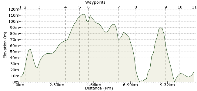
Ascent
135m (442ft)
Descent
128m (419ft)
Max. Elevation
120m (393ft)
Altitude Gain & Loss
263m (861ft)
Start & End
St Bees
Distance
11.10km
(6.9mi)
(6.9mi)
Duration
~3:30h
Difficulty
Moderate
Ordnance Survey Map
This walk circuits the headland near St Bees, best-known to walkers as the starting point for the Coast to Coast walk. There's plenty to enjoy on this shorter walk, including the lighthouse and the bird colonies on the cliffs around the headland.
Walk Functions
Share
Nearby Walks
Pillar from Ennerale
A hard, circular walk (mountain (above 600m)) starting in Cumbria, England, about 40.00km (24.85 mi) long, duration: ~15:15h.The Wagon Way
A leisurely, circular walk (coast) starting in Cumbria, England, about 4.50km (2.80 mi) long, duration: ~1:15h.Muncaster Fell and Glannoventa Fort
A moderate, circular walk (low hills and fells (below 600m)) starting in Cumbria, England, about 14.50km (9.01 mi) long, duration: ~4:15h.Walk Map
- $walk->POI array(0)
Waypoints
OS Grid NX969118
Take the train to St Bees station.
OS Grid NX967122
Head left out of the station, then right along Abbey Road. At the junction, turn left along Scale Barrow towards the coast.
About 0.38 km (~0.24 miles) from 
OS Grid NX960126
Not the most charming of village names, but don't let that put you off. Continue through the village along the road.
About 0.83 km (~0.52 miles) from 
OS Grid NX961143
At Sandwith Newtown, teurn left at the first junction.
About 1.69 km (~1.05 miles) from 
OS Grid NX957149
Follow the road and keep heading towards the beach.
About 0.73 km (~0.45 miles) from 
OS Grid NX956154
You join the coastal path at Saltom Bay. Head southwards along the path.
About 0.51 km (~0.32 miles) from 
OS Grid NX940144
As you turn the corner, you reach St Bees lighthouse. This is a new lighthouse; the old one was the last coal-powered lighthouse in Britain.
About 1.89 km (~1.17 miles) from 
OS Grid NX943134
Continue along the path to St Bees Head, home to some black guillemots: www.rspb.org.uk/discoverandenjoynature/seenature/reserves/guide/s/stbeeshead
About 1.08 km (~0.67 miles) from 
OS Grid NX953118
Continue past Fleswick Bay and on to South Head. This is the start of the coast to coast path (not marked on OS maps as it's not an official long-distance path).
About 1.87 km (~1.16 miles) from 
OS Grid NX962117
Just beyond the camping and caravan park, head up Beech Road into St Bees.
About 0.86 km (~0.53 miles) from 
 St Bees
OS Grid NX971118
The Queens Hotel near the station is a good spot for the post-walk pint, and popular with those setting off on the Coast to Coast.
About 0.86 km (~0.53 miles) from 

1 comment... join the discussion!
Bert Hatley
Great help. The only site I could find that gave the info I needed.