Looping around Laugharne
A moderate walk (coast) in Carmarthenshire, Wales, about 13.00km (8.08 mi) long with an estimated walking time of about 4:00h. It is suitable for families with children, but unsuitable for prams & pushchairs, wheelchairs.
Elevation Profile
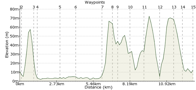
Ascent
144m (472ft)
Descent
142m (465ft)
Max. Elevation
80m (262ft)
Altitude Gain & Loss
286m (937ft)
Start & End
Laugharne
Distance
13.00km
(8.08mi)
(8.08mi)
Duration
~4:00h
Difficulty
Moderate
Ordnance Survey Map
This village, just outside Pembrokeshire national park, is famous for being the inspiration for Dylan Thomas' drama 'Under Milk Wood'. The village itself warrants a good explore, but the estuary to the north and south also demand your time. Look out for waders on the mud when the tide is out.
Walk Functions
Share
Nearby Walks
Rhossili Bay and the Gower coastline
A moderate, linear walk (coast) starting in West Glamorgan, Wales, about 17.20km (10.69 mi) long, duration: ~5:30h.Manorbier to Tenby - the Pembrokeshire Coast
A moderate, linear walk (coast) starting in Pembrokeshire (Sir Benfro), Wales, about 11.90km (7.39 mi) long, duration: ~3:30h.Cefn Bryn on Gower
A leisurely, linear walk (low hills and fells (below 600m)) starting in West Glamorgan, Wales, about 8.00km (4.97 mi) long, duration: ~2:30h.Walk Map
- $walk->POI array(0)
Waypoints
OS Grid SN300107
Take the bus to Laugharne, which goes to and from Carmarthen station.
OS Grid SN301106
Walk along the Strand to head towards the Taf estuary.
About 0.13 km (~0.08 miles) from 
OS Grid SN305099
Continue south along the path, leaving the village behind for now.
About 0.81 km (~0.5 miles) from 
OS Grid SN304096
Take the path signed as 'the last verse'.
About 0.25 km (~0.16 miles) from 
OS Grid SN314084
The path follows the dyke, which should keep you out of the worst of the mud.
About 1.59 km (~0.99 miles) from 
OS Grid SN305077
At East Ho, head inland again back towards the village.
About 1.12 km (~0.7 miles) from 
OS Grid SN298096
Return to Salt Ho, not far from where you entered the marshes. Turn left (west) and follow the path.
About 1.97 km (~1.22 miles) from 
OS Grid SN292096
Skirt around this small hill to the south of the village, and cross the road.
About 0.62 km (~0.39 miles) from 
OS Grid SN292100
Continue past the remains of Roche Castle.
About 0.41 km (~0.25 miles) from 
OS Grid SN297108
When you reach the road, head into the village centre again.
About 0.89 km (~0.55 miles) from 
OS Grid SN306110
This is where the famous poet lived in the last few years of his life.
About 0.94 km (~0.58 miles) from 
OS Grid SN311120
If time allows, take the loop to the north of the village to see a little more.
About 1.14 km (~0.71 miles) from 
OS Grid SN302120
Head around the road and then veer south towards the village once more.
About 0.95 km (~0.59 miles) from 
OS Grid SN301114
Pass through the churchyard to finish the walk.
About 0.62 km (~0.39 miles) from 
 Laugharne again
OS Grid SN300106
Finish back in the village for the bus home.
About 0.78 km (~0.48 miles) from 
