Along the river Fal
A leisurely walk (riverside) starting and finishing in Cornwall, England, about 4.60km (2.86 mi) long with an estimated walking time of about 1:15h. It is suitable for families with children, but unsuitable for prams & pushchairs, wheelchairs.
Elevation Profile
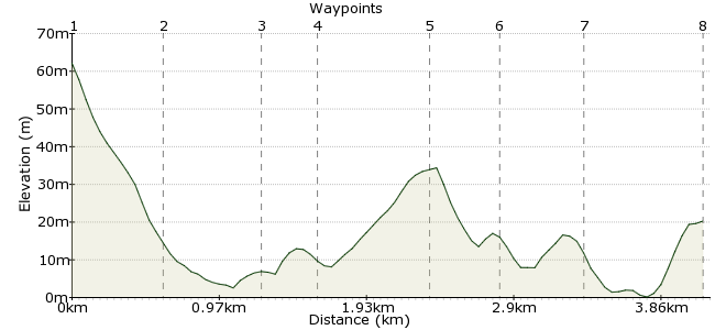
Ascent
30m (98ft)
Descent
72m (236ft)
Max. Elevation
70m (229ft)
Altitude Gain & Loss
102m (334ft)
Start
Penryn
End
Falmouth
Distance
4.60km
(2.86mi)
(2.86mi)
Duration
~1:15h
Difficulty
Leisurely
Ordnance Survey Map
This shortish walk from Penryn to Falmouth follows the northern side of the river Fal, with a short ferry ride to finish. It's one of many wonderful walks in the southwest accessible from the branch lines that reach many corners of this beautiful region: http://greatscenicrailways.co.uk/great-days-out/walks-and-trails
Walk Functions
Share
Nearby Walks
Falmouth coastal walk
A leisurely, circular walk (coast) starting in Cornwall, England, about 2.70km (1.68 mi) long, duration: ~0:45h.Around The Loe in Cornwall
A leisurely, linear walk (countryside) starting in Cornwall, England, about 6.60km (4.10 mi) long, duration: ~2:00h.A Cornish coastal walk
A moderate, linear walk (coast) starting in Cornwall, England, about 15.90km (9.88 mi) long, duration: ~5:15h.Walk Map
- $walk->POI array(0)
Waypoints
OS Grid SW778346
From the station, turn right and then go left down Helston Road.
OS Grid SW784345
Head through the town and to the northern side of the harbour.
About 0.64 km (~0.4 miles) from 
OS Grid SW790343
At the church, pick up the footpath that follows the northern side of the estuary.
About 0.63 km (~0.39 miles) from 
OS Grid SW793346
Easy navigation as you simply hug the shoreline and enjoy the views across the water.
About 0.39 km (~0.24 miles) from 
OS Grid SW800343
Continue past Sailors Creek.
About 0.78 km (~0.48 miles) from 
OS Grid SW805342
Head into the village of Flushing.
About 0.48 km (~0.3 miles) from 
OS Grid SW808337
Continue to the ferry terminal to head across the river Fal. Times are available here: www.falriver.co.uk
About 0.55 km (~0.34 miles) from 
 Falmouth
OS Grid SW806329
Once across, you can walk through the town to the station, or pick up the bus nearby.
About 0.83 km (~0.52 miles) from 

1 comment... join the discussion!
Timwoods
Just to note, that most walks along the Cornish coastline are a little bit longer than our info suggests, due to the wiggly nature of the paths! This one is more like 5 miles.