Falmer to Lewes
A moderate walk (low hills and fells (below 600m)) starting and finishing in Brighton and Hove, England, about 12.80km (7.95 mi) long with an estimated walking time of about 4:00h. It is unsuitable for families with children, prams & pushchairs, wheelchairs.
Elevation Profile
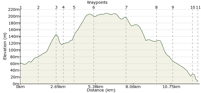
Ascent
163m (534ft)
Descent
220m (721ft)
Max. Elevation
210m (688ft)
Altitude Gain & Loss
383m (1255ft)
Start
Falmer
End
Lewes
Distance
12.80km
(7.95mi)
(7.95mi)
Duration
~4:00h
Difficulty
Moderate
Ordnance Survey Map
 Car Free Walks TeamCreated by GaryShipp on 08 Sep 2008
A half day walk taking in some of the best view points on the South Downs. Start at Falmer, which has a station and good bus links from Brighton.
Walk Functions
Share
Nearby Walks
Castle Hill Nature Reserve - car-free thanks to cooking oil!
A leisurely, circular walk (low hills and fells (below 600m)) starting in East Sussex, England, about 5.50km (3.42 mi) long, duration: ~2:00h.Basin Stroll
A leisurely, linear walk (countryside) starting in East Sussex, England, about 6.60km (4.10 mi) long, duration: ~2:15h.South Downs Way: Housedean Farm to Pyecombe
A moderate, linear walk (low hills and fells (below 600m)) starting in East Sussex, England, about 11.10km (6.90 mi) long, duration: ~3:30h.Walk Map
- $walk->POI array(0)
Waypoints
OS Grid TQ345085
Start of the walk
OS Grid TQ336095
The quintessential English Stately Home village, complete with manor house, church and tea rooms . . .
About 1.35 km (~0.84 miles) from 
OS Grid TQ336107
Go staright over here to walk down a wonderful path through the beech trees - best in Autumn when the leaves turn golden.
About 1.19 km (~0.74 miles) from 
OS Grid TQ338113
Go through the gate here and follow the line of the fence
About 0.59 km (~0.37 miles) from 
OS Grid TQ343117
Either continue in the direction you've been headng and pas via Streat Hill Farm, or extend the walk by turning northwards and a few more contours to meet the South Downs Way to the East of Ditchling Beacon.
About 0.64 km (~0.4 miles) from 
OS Grid TQ352127
This long distance path travels 100 miles between Eastbourne and Winchester. Head eastwards towards Lewes.
About 1.32 km (~0.82 miles) from 
OS Grid TQ374124
Admire the view northwards across the Weald to the Ashdown Forest and face the sea and the lights of Brighton.
About 2.21 km (~1.37 miles) from 
OS Grid TQ392112
Once one of the most impressive views from and race course in the land. Now a gallops.
About 2.17 km (~1.35 miles) from 
OS Grid TQ402108
From here you can take any number of routes into town. But make sure you leave time to explore this beautiful market town, with it's Castle, boutique shopping and Brewery (tours available).
About 1.11 km (~0.69 miles) from 
OS Grid TQ413100
Climb to the top for beautiful views of the surrounding town and countryside.
About 1.33 km (~0.83 miles) from 
 Lewes Station
OS Grid TQ416098
For frequent services to London, Ashford, Eastbourne, and Brighton.
About 0.34 km (~0.21 miles) from 

6 comments... join the discussion!
Jo Palmer
A lovely route. We thoroughly enjoyed this relatively gentle ramble that gave us beautiful views over the downs. An afternoon well spent.
Anne Heining
Just to correct a previous comment, we live in Falmer and it is in fact considered to be part of Brighton (Brighton is included in our postal address). Slightly confusing but the author is not incorrect. We have yet to do the walk but have been inspired by this post!
Timwoods
Hi Helen You could be right, sometimes the distances are overestimated due to the way the website calculates them, looks to me like 11-12 km at a rough estimate.
Helen Burrows
Hi, This walk via Black Cap hill, beacon Harry is not as much as 9 miles, maybe 9Km at most, cheers, helen
Timwoods
Good point! I expect the author counted Falmer as part of Brighton, but we'll correct it as it isn't really. Thanks Tim
Charlotte
This is a lovely walk but it is not a walk from Brighton to Lewes its a walk from Falmer to Lewes.