Mersea Island
A leisurely walk (coast) starting and finishing in Essex, England, about 3.40km (2.11 mi) long with an estimated walking time of about 1:00h. It is unsuitable for families with children, prams & pushchairs, wheelchairs.
Elevation Profile
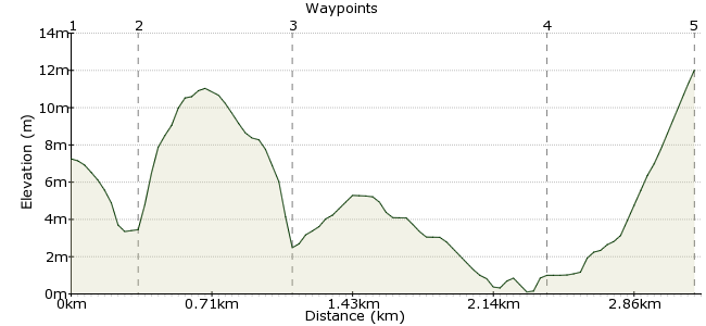
Ascent
12m (39ft)
Descent
8m (26ft)
Max. Elevation
20m (65ft)
Altitude Gain & Loss
20m (65ft)
Start
West Mersea
End
The Strood Road
Distance
3.40km
(2.11mi)
(2.11mi)
Duration
~1:00h
Difficulty
Leisurely
Ordnance Survey Map
Mersea Island sits at the mouth of the River Colne in Essex. It's famous for its oysters, and this walk takes you past restaurants selling them and cages growing them. It's also a great place to get some fresh sea air. It's possible to walk all the way around the island, but for something a little more managable, head for the main town of West Mersea and wander round the western edge of the island.
Walk Functions
Share
Nearby Walks
Cymbeline Meadow
A leisurely, circular walk (city/town) starting in Essex, England, about 3.90km (2.42 mi) long, duration: ~1:00h.Dedham Vale and the Stour Valley
A leisurely, linear walk (riverside) starting in Suffolk, England, about 6.40km (3.98 mi) long, duration: ~1:45h.Frinton to Walton - the posh end of Essex
A moderate, linear walk (coast) starting in Essex, England, about 10.50km (6.52 mi) long, duration: ~3:00h.Walk Map
- $walk->POI array(0)
Waypoints
OS Grid TM008124
Regular buses run from Colchester to West Mersea. Get off in the town centre near the church. It's just a short walk down to Monkey Beach (there are no monkeys, though - better to tell you now to avoid disappointment).
OS Grid TM005123
Th area around the harbour is worth exploring - several fine boats sit in the muddy inlets, and there are good views across to Cobmarsh Island and beyond. Look out too for the wooden stalls, in which oysters are harvested. Several footpaths weave in and out of the mudflats, so pick your own way.
About 0.33 km (~0.21 miles) from 
OS Grid TM000129
Just beyond the harbour, a path leads through some newish houses, looking like it goes nowhere in particular. In fact, it leads you to the footpath that runs along the Strood Channel. Mersea Island attracts a diverse range of bird species, so keep your eyes on the muddy banks of the channel.
About 0.77 km (~0.48 miles) from 
OS Grid TM007141
This second half feels very different to the section through West Mersea - really quite remote, despite being in busy Essex. There are good views over to Ray Island, which is managed by the National Trust.
About 1.38 km (~0.86 miles) from 
 Back to the road
OS Grid TM015141
The path leaves the muddy coastline and returns to the B1025. There are bus stops along the road; head away from the coast towards West Mersea and you will soon spot one to pick up the bus home.
About 0.80 km (~0.5 miles) from 
