Enjoying the Medway
A leisurely walk (riverside) starting and finishing in Kent, England, about 9.40km (5.84 mi) long with an estimated walking time of about 2:45h. It is unsuitable for families with children, prams & pushchairs, wheelchairs.
Elevation Profile
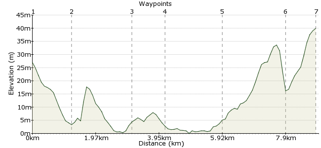
Ascent
40m (131ft)
Descent
27m (88ft)
Max. Elevation
40m (131ft)
Altitude Gain & Loss
67m (219ft)
Start
Rainham Station
End
Newington Station
Distance
9.40km
(5.84mi)
(5.84mi)
Duration
~2:45h
Difficulty
Leisurely
Ordnance Survey Map
There's plenty of good walking along the River Medway, just a short hop from Central London. A good stretch is the section around Horsham Marsh. The mudflats around this section are major feeding grounds for birdlife, so bring your binoculars. Start at Rainham Station and finish at Newington, both on the line from London Bridge.
Walk Functions
Share
Nearby Walks
The marshes of the Medway
A strenuous, linear walk (countryside) starting in Kent, England, about 23.50km (14.60 mi) long, duration: ~7:00h.Southend seafront
A leisurely, linear walk (coast) starting in Essex, England, about 4.50km (2.80 mi) long, duration: ~1:15h.A woodland walk near Horndon on the Hill
A leisurely, circular walk (woodland) starting in Essex, England, about 7.70km (4.78 mi) long, duration: ~2:30h.Walk Map
- $walk->POI array(0)
Waypoints
OS Grid TQ818663
From the station, head northeast along Station Road for about 1km. At the end, turn right and after 300m you will see a footpath sign.
OS Grid TQ828671
The path cuts across two fields and hits the coast at the wharf. At this point, you join the Saxon Shore Way - follow it east.
About 1.24 km (~0.77 miles) from 
OS Grid TQ844682
The path leaves the coast and passes through Horsham Farm. As you walk past the northern side of Upchurch, the route passes through some delightful orchards. No scrumping!
About 1.96 km (~1.22 miles) from 
OS Grid TQ850690
The path rejoins the coast at Hamgreen Saltings, and this is the best spot for a bit of twitching. The mudflats out to Milfordhope Saltings are always crammed with feeding birds of many species.
About 1.01 km (~0.63 miles) from 
OS Grid TQ859674
Carry on along the Saxon Shore Way to Lower Halstow. Here, leave the coast and head inland; a path runs through the village and on towards Newington. A stop at the Three Tuns is highly recommended - great beers, great food.
About 1.83 km (~1.14 miles) from 
OS Grid TQ862654
The path cuts across Broom Downs and joins a road just south of Wardwell Wood. Pick up the lane into Newington.
About 2.02 km (~1.26 miles) from 
 Newington
OS Grid TQ857647
The station is on the northern side of the town.
About 0.91 km (~0.57 miles) from 
