Attenborough Nature Reserve and the Trent Valley Way
A moderate walk (riverside) starting and finishing in Nottinghamshire, England, about 10.00km (6.21 mi) long with an estimated walking time of about 2:45h. It is unsuitable for families with children, prams & pushchairs, wheelchairs.
Elevation Profile
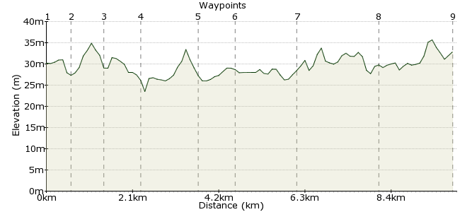
Ascent
8m (26ft)
Descent
6m (19ft)
Max. Elevation
40m (131ft)
Altitude Gain & Loss
14m (45ft)
Start
Attenborough Station
End
Long Eaton
Distance
10.00km
(6.21mi)
(6.21mi)
Duration
~2:45h
Difficulty
Moderate
Ordnance Survey Map
Attenborough Nature Reserve, just 10 minutes away from Nottingham city centre, provides a welcome breath of fresh air. The reserve is managed by the Wildlife Trust, and birdwatchers love it here - visit www.attenboroughnaturecentre.co.uk for some of the species you may spot. The reserve and its surroundings are also perfect for a morning or afternoon stroll. This route starts at Attenborough Station and passes through the reserve before joining the Trent Valley Way to Long Eaton.
Walk Functions
Share
Nearby Walks
Nottingham University Lakeside walk
A leisurely, circular walk (countryside) starting in Nottinghamshire, England, about 1.80km (1.12 mi) long, duration: ~0:15h.Ashbourne to Buxton
A hard, linear walk (low hills and fells (below 600m)) starting in Derbyshire, England, about 40.40km (25.10 mi) long, duration: ~13:15h.Stanton Moor and the Nine Ladies
A leisurely, circular walk (countryside) starting in Derbyshire, England, about 3.70km (2.30 mi) long, duration: ~1:00h.Walk Map
- $walk->POI array(0)
Waypoints
OS Grid SK517345
From the station, turn left and follow Attenborough Lane towards The Strand. At the junction, turn left along The Strand to the footpath at the end.
OS Grid SK524347
Follow the path heading north through the reserve. After about 200m, the path passes through some woodland.
About 0.67 km (~0.42 miles) from 
OS Grid SK528353
The path veers east and joins the Trent Valley Way, which runs alongside the eastern side of the reserve.
About 0.74 km (~0.46 miles) from 
OS Grid SK528345
The path along the eastern side runs right next to the water and is the best place to spot some of the reserve's bird species.
About 0.81 km (~0.5 miles) from 
OS Grid SK516339
Call in at the visitor centre to find out what has been spotted recently.
About 1.40 km (~0.87 miles) from 
OS Grid SK512331
Rejoin the TVW heading southwest.
About 0.86 km (~0.53 miles) from 
OS Grid SK512317
Stay on the TVW as it hugs the meanders on the river.
About 1.41 km (~0.88 miles) from 
OS Grid SK494309
Just beyond the railway, a footpath heads northwest past the golf course towards Long Eaton.
About 1.92 km (~1.19 miles) from 
 Long Eaton
OS Grid SK481321
Finish your walk in Long Eaton, from where there are trains and buses back home.
About 1.76 km (~1.09 miles) from 
