Llyn Brenig Archaeological Trail
A leisurely walk (countryside) in national park Snowdonia in Denbighshire, Wales, about 4.20km (2.61 mi) long with an estimated walking time of about 1:15h. It is suitable for families with children, but unsuitable for prams & pushchairs, wheelchairs.
Elevation Profile
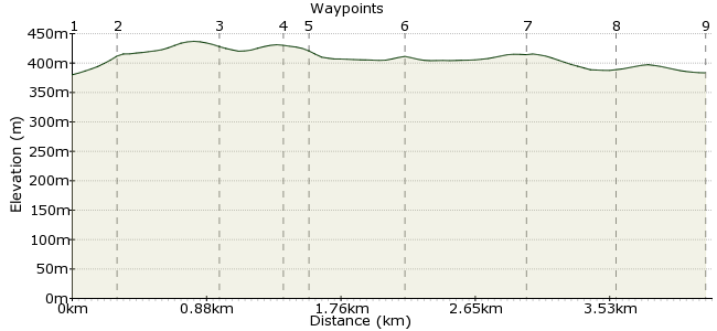
Ascent
53m (173ft)
Descent
50m (164ft)
Max. Elevation
440m (1443ft)
Altitude Gain & Loss
103m (337ft)
Start & End
Llyn Brenig
Distance
4.20km
(2.61mi)
(2.61mi)
Duration
~1:15h
Difficulty
Leisurely
Ordnance Survey Map
The 72 bus from Corwen to Denbigh stops at the Archaeological Trail at the north end of Llyn Brenig - two buses a day, Saturdays and Sundays (they are seasonal though, so check at www.denbighshire.gov.uk). Follow the Trail round to view bronze age cairns, ancient hafotti and the site of a medieval grange. Then follow the track along the lake and enjoy the stunning views of the Hiraethog moors and Snowdonia. Finish the walk by crossing the dam and enjoying a well earned drink in the Visitor Centre Cafe before catching the bus back. Total walk length is approximately 6 miles. You can download a guide to the route here: www.cpat.org.uk/walks/brenig.pdf
Walk Functions
Share
Nearby Walks
Denbigh Castle and River Ystrad Valley
A leisurely, circular walk (countryside) starting in Denbighshire, Wales, about 10.20km (6.34 mi) long, duration: ~3:00h.Pentrefoelas
A moderate, circular walk (countryside) starting in Gwynedd, Wales, about 11.70km (7.27 mi) long, duration: ~3:45h.Llangernyw
A leisurely, circular walk (countryside) starting in Clwyd, Wales, about 6.10km (3.79 mi) long, duration: ~2:00h.Walk Map
- $walk->POI array(0)
Waypoints
OS Grid SH983573
Start the walk at the bus stop near Llyn Brenig. The journey itself is great, through some lovely countryside. Just nearby is a large Bronze Age burial mound known as Boncyn Arian.
OS Grid SH985574
Follow the track to the edge of the woods.
About 0.30 km (~0.19 miles) from 
OS Grid SH988568
The track heads south along the edge of the forest.
About 0.70 km (~0.43 miles) from 
OS Grid SH989564
The next cairn dates from 1950-1650 BC and was originally built as a ring cairn with an open centre.
About 0.35 km (~0.22 miles) from 
OS Grid SH990563
Just nearby is Hen Ddinbych, a 13th Century enclosure used to keep sheep in.
About 0.20 km (~0.12 miles) from 
OS Grid SH995562
Head a little south east to see the Bronze Age kerb cairn.
About 0.51 km (~0.32 miles) from 
OS Grid SH987563
Retrace your steps to reach another cairn, again dating back to the Bronze Age.
About 0.77 km (~0.48 miles) from 
OS Grid SH984567
Continue to meet the track at Hafotty Siôn Llwyd.
About 0.52 km (~0.32 miles) from 
 Back to the visitor centre
OS Grid SH983573
Walk alongside the llyn to return to visitor centre. When walking, keep an eye on your watch - only two buses home each day!
About 0.59 km (~0.37 miles) from 
