Birmingham's canals
A moderate walk (canal) starting and finishing in Birmingham, England, about 12.40km (7.71 mi) long with an estimated walking time of about 3:30h. It is suitable for families with children, but unsuitable for prams & pushchairs, wheelchairs.
Elevation Profile
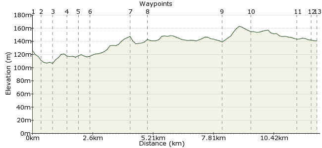
Ascent
60m (196ft)
Descent
46m (150ft)
Max. Elevation
170m (557ft)
Altitude Gain & Loss
106m (346ft)
Start
Birmingham
End
Oldbury
Distance
12.40km
(7.71mi)
(7.71mi)
Duration
~3:30h
Difficulty
Moderate
Ordnance Survey Maps
It's a (fairly) well known fact that Birmingham has more canals than Venice. OK, you can't finish a walk around them with a pizza in St Mark's Square, but on the flip side a pizza in the Bull Ring doesn't cost £25.
The canal network was constructed to serve the city during the industrial revolution. Nowadays the main focus is tourism, and a wander along the towpath is a great way to get a taste of this city. This walk starts right in the heart of Britain's second largest city, and heads west through the districts to Sandwell.
For more info about the canal, visit: www.waterscape.com/in-your-area/warwickshire/birmingham
Walk Functions
Share
Nearby Walks
Worcestershire woods and water
A leisurely, circular walk (canal) starting in Worcestershire, England, about 7.60km (4.72 mi) long, duration: ~2:00h.A walk through history - Ironbridge Gorge
A leisurely, circular walk (riverside) starting in Shropshire, England, about 5.50km (3.42 mi) long, duration: ~1:45h.Buildwas-Ironbridge walk
A moderate, circular walk (riverside) starting in Shropshire, England, about 16.90km (10.50 mi) long, duration: ~5:15h.Walk Map
- $walk->POI array(0)
Waypoints
OS Grid SP073867
Take the train to Moor Street Station. From here, follow the signs to Millennium Point and Thinktank; before you reach them, turn right into Fazeley Street.
OS Grid SP077868
Walk along Fazeley Street to the junction with New Canal Street. Here you can join the canal towpath.
About 0.37 km (~0.23 miles) from 
OS Grid SP081871
Join the canal towpath and continue under the railway bridge.
About 0.42 km (~0.26 miles) from 
OS Grid SP079876
Under another tunnel, the path takes you past Ashted Locks and Aston Science Park.
About 0.52 km (~0.32 miles) from 
OS Grid SP076880
Head under the Ashton Expressway, where the Birmingham and Fazeley Canal meets the main canal.
About 0.56 km (~0.35 miles) from 
OS Grid SP072878
Continue along the towpath past a series of locks - this section runs right through the centre of Birmingham.
About 0.43 km (~0.27 miles) from 
OS Grid SP059868
The canal passes the NIA, one of Birmingham's main venues.
About 1.67 km (~1.04 miles) from 
OS Grid SP052870
The canal passes through Ladywood.
About 0.67 km (~0.42 miles) from 
OS Grid SP028890
The canal path heads west out of the city centre, through the many districts and suburbs of the second city. At Smethwick Junction, cross the footbridge and follow the right-hand canal. Continue past Smethwick Locks.
About 3.15 km (~1.96 miles) from 
OS Grid SP016892
Continue through the tunnel at Galton Bridge.
About 1.22 km (~0.76 miles) from 
OS Grid SO998899
Pass under the M5 until you reach Spon Lane Junction.
About 1.93 km (~1.2 miles) from 
OS Grid SO994902
Another bridge at Bromford - the history of this industrial city can be seen on all sides.
About 0.52 km (~0.32 miles) from 
 Sandwell & Dudley Station
OS Grid SO992901
Turn off at Bromford Road to reach Sandwell & Dudley Station for the train back into the city centre.
About 0.27 km (~0.17 miles) from 
