Porthcothan to Newquay
A moderate walk (coast) starting and finishing in Cornwall, England, about 12.30km (7.64 mi) long with an estimated walking time of about 3:45h. It is suitable for families with children, but unsuitable for prams & pushchairs, wheelchairs.
Elevation Profile
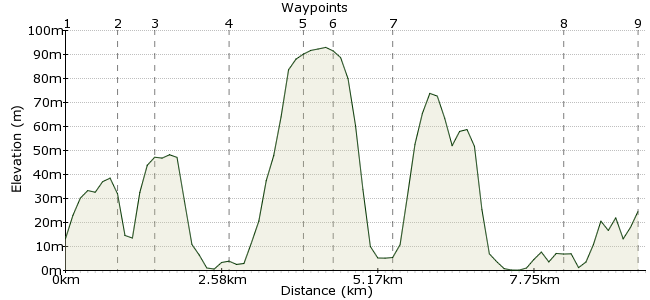
Ascent
74m (242ft)
Descent
63m (206ft)
Max. Elevation
100m (328ft)
Altitude Gain & Loss
137m (448ft)
Start
Porthcothan
End
Newquay, Cornwall, England
Distance
12.30km
(7.64mi)
(7.64mi)
Duration
~3:45h
Difficulty
Moderate
Ordnance Survey Maps
Cornwall's coast. Two words to fill the heart of any walking Englishperson with joy. It's wild/windswept/rugged/winding and many more things besides. While Cornwall attracts most of its visitors in summer, the coast is particularly magnificent in winter, and the towns are quieter too. The coastal bus service connects Newquay with Porthcothan.
This walk is adapted from one provided by Cornwall Tourism Magazine www.cornwalltourismmagazine.com.
Walk Functions
Share
Nearby Walks
The Camel Trail - Wadebridge to Padstow
A leisurely, linear walk (riverside) starting in Cornwall, England, about 8.70km (5.41 mi) long, duration: ~2:30h.A Cornish coastal walk
A moderate, linear walk (coast) starting in Cornwall, England, about 15.90km (9.88 mi) long, duration: ~5:15h.The Camel Trail - Bodmin to Wadebridge
A moderate, linear walk (riverside) starting in Cornwall, England, about 10.80km (6.71 mi) long, duration: ~3:00h.Walk Map
- $walk->POI array(0)
Waypoints
OS Grid SW858719
Start the walk at Porthcothan. Regular buses from Newquay.
OS Grid SW847714
Follow signs in the village for the coastal path and head south (i.e. sea on your right as you walk).
About 1.12 km (~0.7 miles) from 
OS Grid SW844708
This walk follows some of the finest coastline in England, following the weaving bays and coves of Cornwall.
About 0.72 km (~0.45 miles) from 
OS Grid SW849693
This is a popular beauty spot, owned by the National Trust. Pillars of rock rise from the beach, and legend says that the giant Bedruthan used them as stepping stones to cross the bay. It's more likely to have been a process of coastal erosion in my opinion, but then I'm no expert (on giants at least). A cargo ship crashed on one of the stacks in 1846, providing the locals with free silk and food. If you descend to the beach, take care as the tide cuts off parts of the beach and the only way back is the cliff steps.
About 1.55 km (~0.96 miles) from 
OS Grid SW848677
Pass through the village of Trenance; you can just stick to the coastal path.
About 1.59 km (~0.99 miles) from 
OS Grid SW848671
Just outside Trenance is Mawgan Porth, which is a better option for a lunch stop than the village. Either picnic on the beach or head to the Merrymoor Inn: www.merrymoorinn.com
Just opposite the pub is a 13th century church, which has an old wrecked ship in the grounds and many interesting features inside.
About 0.58 km (~0.36 miles) from 
OS Grid SW843660
One of the longest beaches on this section of coastline is Watergate Bay. It's popular with surfers as well as families relaxing on its golden sands.
About 1.21 km (~0.75 miles) from 
OS Grid SW826630
By the time you have reached the southern end of Watergate Bay you are nearly at Newquay. But before entering the town, visit the old fort at Trevelgue Head: bit.ly/ztlqwy
About 3.51 km (~2.18 miles) from 
 Newquay
OS Grid SW815618
Finish in Newquay. The coastal footpath goes by the station, should you wish to head somewhere a little quieter for the evening (Newquay gets very busy in summer).
About 1.60 km (~0.99 miles) from 
