Along the Crinan canal
A moderate walk (canal) starting and finishing in Argyll and Bute, Scotland, about 13.00km (8.08 mi) long with an estimated walking time of about 3:45h. It is suitable for families with children, but unsuitable for prams & pushchairs, wheelchairs.
Elevation Profile
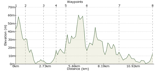
Ascent
20m (65ft)
Descent
51m (167ft)
Max. Elevation
70m (229ft)
Altitude Gain & Loss
71m (232ft)
Start
Crinan
End
Ardrishaig, Lochgilphead, Argyll, Scotland
Distance
13.00km
(8.08mi)
(8.08mi)
Duration
~3:45h
Difficulty
Moderate
Ordnance Survey Map
This walk follows an ancient canal built to connect Loch Fyne with the Sound of Jura. It passes through beautiful forested countryside and with easy navigation you can relax and focus on the surrounds. The main transport hub is Lochgilphead, which is connected to Glasgow. Buses from here head to Crinan at the start of the walk, but there are only two a day so make sure you check the times.
I found this walk in the Ramblers winter magazine.
Walk Functions
Share
Nearby Walks
Ben Cruachan
A moderate, circular walk (mountain (above 600m)) starting in Argyll and Bute, Scotland, about 10.60km (6.59 mi) long, duration: ~6:00h.The Cock of Arran
A moderate, circular walk (coast) starting in Ayrshire, Scotland, about 10.10km (6.28 mi) long, duration: ~3:00h.Beinn Eunaich and Beinn a' Chochuill
A moderate, circular walk (mountain (above 600m)) starting in Argyll and Bute, Scotland, about 15.00km (9.32 mi) long, duration: ~7:30h.Walk Map
- $walk->POI array(0)
Waypoints
OS Grid NR785941
Start the walk at Crinan. Buses run here from Lochgilphead. The canal begins at the town, on the northern edge. Pick up the towpath that runs on the northern side of the canal.
OS Grid NR790932
The path follows the canal heading southeast, with forest on the southern side and the Argyll countryside on the northern.
About 0.99 km (~0.62 miles) from 
OS Grid NR804924
Head past the marina near Bellanoch.
About 1.64 km (~1.02 miles) from 
OS Grid NR812916
Follow the canal while admiring the surrounds. To the north is Moine Mhor nature reserve.
About 1.11 km (~0.69 miles) from 
OS Grid NR819912
At Dunardry, the canal begins a series of locks, as the canal rises slightly.
About 0.81 km (~0.5 miles) from 
OS Grid NR839908
Next stop Cairnbaan, where there is a hotel for lunch if you should fancy: www.cairnbaan.com
About 1.97 km (~1.22 miles) from 
OS Grid NR858885
The canal reaches Lochgilphead, where you can end the walk if you like. Buses back towards Glasgow head from here, and you can pass the time sitting on the lochside. For those who like completion, continue along the canal path.
About 2.94 km (~1.83 miles) from 
 Ardrishaig
OS Grid NR851854
The canal ends at Ardrishaig on Loch Gilp. You can retrace your steps from here, or catch a bus to Lochgilphead.
About 3.20 km (~1.99 miles) from 
