Bosham to Emsworth
A moderate walk (coast) starting and finishing in West Sussex, England, about 13.60km (8.45 mi) long with an estimated walking time of about 4:00h. It is suitable for families with children, but unsuitable for prams & pushchairs, wheelchairs.
Elevation Profile
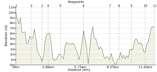
Ascent
8m (26ft)
Descent
11m (36ft)
Max. Elevation
10m (32ft)
Altitude Gain & Loss
19m (62ft)
Start
Bosham
End
Emsworth, Hampshire, England
Distance
13.60km
(8.45mi)
(8.45mi)
Duration
~4:00h
Difficulty
Moderate
Ordnance Survey Map
This walk combines two pleasant coastal towns with some good coastal scenery around Chichester Harbour. Start at Bosham, in West Sussex, which is well worth exploring, especially the Bosham Walk shops and the quayside. The route then follows coastal footpaths around the channels and mudflats that mark this coast - bird watchers will want to bring their binoculars with them. Finish at Emsworth, another interesting town just over the border in Hampshire.
Walk Functions
Share
Nearby Walks
Kingley Vale - the oldest yews in England?
A leisurely, circular walk (countryside) starting in West Sussex, England, about 9.50km (5.90 mi) long, duration: ~3:30h.Arundel pub walk
A leisurely, circular walk (riverside) starting in West Sussex, England, about 5.30km (3.29 mi) long, duration: ~1:45h.A walk around East Meon
A moderate, circular walk (countryside) starting in Hampshire, England, about 11.90km (7.39 mi) long, duration: ~3:45h.Walk Map
- $walk->POI array(0)
Waypoints
OS Grid SU812054
Take the train to Bosham.
OS Grid SU805041
Head into the village and go to Bosham Walk, which has several interesting craft shops. More info at www.bosham-walk.co.uk
About 1.45 km (~0.9 miles) from 
OS Grid SU804052
Take the footpath north from the village to the A259. (If you are short of time, you can miss out the trip into Bosham.)
About 1.08 km (~0.67 miles) from 
OS Grid SU798052
Avoid walking on the main road by taking the two side roads which form a triangle with the A259.
About 0.59 km (~0.37 miles) from 
OS Grid SU794041
A footpath heads south to Chidham and continues around the peninsular. The real treat is out on the mudflats of the Bosham Channel, which has plenty of wading birds when the tide is out.
About 1.20 km (~0.75 miles) from 
OS Grid SU791019
The southern tip of Cobnor Point is about the halfway point of the walk.
About 2.20 km (~1.37 miles) from 
OS Grid SU778041
Continue along the coastal path to Chidham Point.
About 2.55 km (~1.58 miles) from 
OS Grid SU777049
The path hugs the coastline beneath Nutbourne.
About 0.83 km (~0.52 miles) from 
OS Grid SU765051
At Prinstead, pick up the Sussex Border Path to Emsworth. There is a station at Southbourne too if you want a shorter day out.
About 1.14 km (~0.71 miles) from 
OS Grid SU753054
Emsworth Marina makes a fitting end to the main part of the walk www.emsworth-marina.co.uk
About 1.26 km (~0.78 miles) from 
 Emsworth Station
OS Grid SU748062
Continue through the town to the station for the train home.
About 0.95 km (~0.59 miles) from 

1 comment... join the discussion!
Steve
I have tried to down load the GPX file for your Bosham to Emsworth walk but without success. I get various messages saying that the file is corrupt or that I need to subscribe to Adobe PDF reader. Can you tell me how to down load the GPX, I have a new Oregon 650t which I'm learning to use. Many thanks Steve