Blakeney Point on the Norfolk Coast
A leisurely walk (coast) starting and finishing in Norfolk, England, about 8.00km (4.97 mi) long with an estimated walking time of about 2:15h. It is unsuitable for families with children, prams & pushchairs, wheelchairs.
Elevation Profile
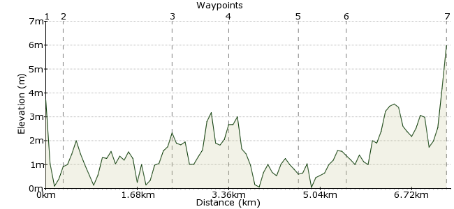
Ascent
7m (22ft)
Descent
4m (13ft)
Max. Elevation
10m (32ft)
Altitude Gain & Loss
11m (35ft)
Start
Salthouse
End
Morston
Distance
8.00km
(4.97mi)
(4.97mi)
Duration
~2:15h
Difficulty
Leisurely
Ordnance Survey Map
This walk takes you along one of the finest sections of the north Norfolk coast - around Blakeney Nature Reserve. Starting in the village of Salthouse, follow the Norfolk Coast Path towards Cley next the Sea, turning off just beforehand to explore the shingle beach. All sorts of marine life is found here, and the big draw are the seals. From the beach, it's then a further walk along the coastal path to Morston, where you can pick up the Coasthopper bus.
Walk Functions
Share
Nearby Walks
Around Bodham and Holt
A leisurely, walk (countryside) starting in Norfolk, England, about 6.30km (3.91 mi) long, duration: ~1:45h.Sheringham walk
A moderate, circular walk (countryside) starting in Norfolk, England, about 9.60km (5.97 mi) long, duration: ~3:00h.East and West Runton
A leisurely, walk (coast) starting in Norfolk, England, about 4.60km (2.86 mi) long, duration: ~1:15h.Walk Map
- $walk->POI array(0)
Waypoints
OS Grid TG074439
Take the Coasthopper bus to Salthouse, a village on the edge of the salt marshes. Buses run from Sheringham, the nearest station (on the Bittern Line). The village has an interesting 16th century church - worth a visit before beginning the walk.
OS Grid TG077441
From the churchyard, a footpath crosses the marsh and heads towards the beach. Head west along the beach.
About 0.34 km (~0.21 miles) from 
OS Grid TG057449
The route follows the shingle beach that runs north of the marshes. Cley marshes are a bird haven, with all sorts of rare species breeding and feeding here.
About 2.10 km (~1.3 miles) from 
OS Grid TG046452
You can walk right to the end of the beach to Blakeney Point to spot grey and common seals. However, the National Trust-owned beach is sometimes closed to allow the wildlife to breed peacefully, or due to tidal flooding. It's also a very exposed place - it can be a long walk on wet and windy days!
About 1.15 km (~0.71 miles) from 
OS Grid TG036444
Once you have explored Blakeney beach, rejoin the Norfolk Coastal Path near Cley next the Sea and continue towards Blakeney. Enjoy the fantastic views across the marshes on this section.
About 1.28 km (~0.8 miles) from 
OS Grid TG027441
On the northern side of Blakeney village is the quay, formerly a working port and now busy with sailing boats. There are great views over Blakeney Freshes, the salt marshes to the west of the village.
About 0.92 km (~0.57 miles) from 
 Morston
OS Grid TG007439
Enjoy the views across the marshes as you continue to Morston, the next village along the coast. There is also a quay here. If you didn't get to see the seals on your walk, take a boat from here out to spot them. Alternatively, enjoy a pint in the Anchor Inn - an old smuggler's drinking den!
About 1.98 km (~1.23 miles) from 

1 comment... join the discussion!
Eddie Morley
Looking forward to this one and a lot more Thanks.