Saltfleetby Dunes
A moderate walk (coast) in Lincolnshire, England, about 14.50km (9.01 mi) long with an estimated walking time of about 4:15h. It is suitable for families with children, but unsuitable for prams & pushchairs, wheelchairs.
Elevation Profile
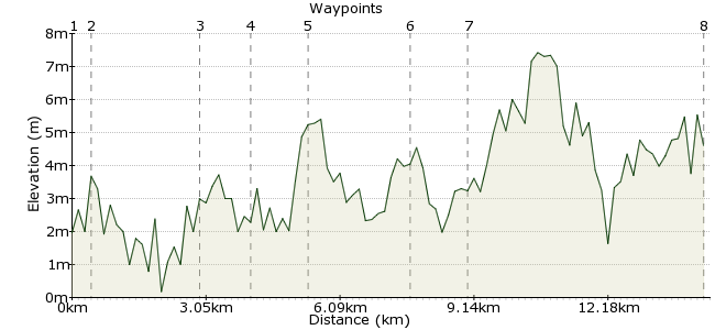
Ascent
6m (19ft)
Descent
4m (13ft)
Max. Elevation
10m (32ft)
Altitude Gain & Loss
10m (32ft)
Start & End
Mablethorpe
Distance
14.50km
(9.01mi)
(9.01mi)
Duration
~4:15h
Difficulty
Moderate
Ordnance Survey Map
This walk from Mablethorpe heads to the nature reserve of Saltfleetby Dunes, an area of dunes and marshes that is in a constant state of flux. It's famous for being one of the few places in the UK where you can see natterjack toads, and makes for a good stroll in this lovely part of the country. You can find out more about the wildlife from the Lincolnshire Wildlife Trust's website: www.lincstrust.org.uk/reserves/nr/reserve.php?mapref=41
One small frustration with this walk is that it's not that convenient for linear walks, which is always a shame with a coastal walk. Getting back to Mablethorpe from Saltfleet requires changing in Louth or Grimsby – not very practical (and taking over 2 hours). A much better option is to just walk back to Mablethorpe, but bear this in mind when determining how long to spend exploring the dunes.
Walk Functions
Share
Nearby Walks
Kings Head 11 mile loop from Ludford
A moderate, circular walk (countryside) starting in Lincolnshire, England, about 14.40km (8.95 mi) long, duration: ~4:30h.A walk in the Wolds
A moderate, linear walk (countryside) starting in Lincolnshire, England, about 10.90km (6.77 mi) long, duration: ~3:00h.Hopping along the Norfolk coast
A moderate, linear walk (coast) starting in Norfolk, England, about 14.10km (8.76 mi) long, duration: ~4:15h.Walk Map
- $walk->POI array(0)
Waypoints
OS Grid TF504850
Start the walk in Mablethorpe. Head down to the seafront from the town centre.
OS Grid TF508852
Walk along the seafront road, past the amusement park.
About 0.43 km (~0.27 miles) from 
OS Grid TF491869
The road heads briefly inland once past the holiday camps at the northern end of the town.
About 2.45 km (~1.52 miles) from 
OS Grid TF486879
There is a public access route along the stream by the gap works.
About 1.08 km (~0.67 miles) from 
OS Grid TF483892
At the village of Theddlethorpe St Helens, you reach the main area of dunes. There are plenty of options for exploring the area, particularly the birdlife. More information from Natural England, who manage the reserve: www.naturalengland.org.uk/ourwork/conservation/designations/nnr/1006128.aspx
About 1.33 km (~0.83 miles) from 
OS Grid TF471911
Explore away to your heart's content! Note that the maps mark this as a danger area, due to the shifting nature of the marshland, so do check for advice before visiting.
About 2.21 km (~1.37 miles) from 
OS Grid TF478900
You can continue heading north until Saltfleet, but bus connections back to Mablethorpe are very poor, so it is quicker to retrace your steps back along the coast.
About 1.21 km (~0.75 miles) from 
 Back to Mablethorpe
OS Grid TF506855
Continue back into Mablethorpe for some chips on the beach.
About 5.35 km (~3.32 miles) from 
