Brentford to Marble Hill House
A leisurely walk (riverside) starting and finishing in City of London, England, about 6.40km (3.98 mi) long with an estimated walking time of about 1:45h. It is unsuitable for families with children, prams & pushchairs, wheelchairs.
Elevation Profile
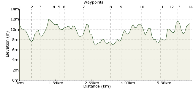
Ascent
9m (29ft)
Descent
9m (29ft)
Max. Elevation
20m (65ft)
Altitude Gain & Loss
18m (58ft)
Start
Brentford High Street
End
Twickenham
Distance
6.40km
(3.98mi)
(3.98mi)
Duration
~1:45h
Difficulty
Leisurely
Ordnance Survey Map
 3Created by John Walker on 11 May 2014
The walk goes from the little town of Brentford, where the Brent River meets the Thames, along the Thames Path to Twickenham. It passes Syon House and Marble Hill House with views of Ham House across the river, a reminder of the time when this stretch of the river was home to many grand houses. This route starts on Brentford High Street. For public transport access from central London travel from Waterloo to Syon Lane station or go to Hammersmith by tube and catch the 267 bus.
Walk Functions
Share
Nearby Walks
WLH3 walk
A leisurely, circular walk (city/town) starting in Greater London, England, about 7.10km (4.41 mi) long, duration: ~2:00h.Richmond Park and beyond
A moderate, linear walk (countryside) starting in Surrey, England, about 11.90km (7.39 mi) long, duration: ~3:30h.Osterley Park to Brentford
A leisurely, linear walk (canal) starting in Greater London, England, about 7.00km (4.35 mi) long, duration: ~1:45h.Walk Map
- $walk->POI array(0)
Waypoints
OS Grid TQ171772
From the Brent Lea bus stop walk about 50m west and turn down a pedestrian path between brick walls, signposted to Syon House.
OS Grid TQ171768
On the left as the path turns right you have views into the Syon House garden with its large glass dome of the Great Conservatory. This dates from around 1830 and was one of the first to be built from iron and glass. Syon House remains in private hands. The heart of the building is a medieval great hall. But in the 1760’s Robert Adam was involved in redesigning the interior which is very lavish and in the neo-classical style (i.e. way over the top). The whole is contained within a rather dreary four-square battlemented exterior. There are refreshment opportunities in the Refectory, part of a garden centre next to the House.
About 0.42 km (~0.26 miles) from 
OS Grid TQ170765
Follow the path just to the right of the brick wall. Off to the right is the parkland remaining from the original Syon estate. Behind the wall, in the grounds of the house, are buried the hidden remains of the abbey, dissolved in 1538.
About 0.25 km (~0.16 miles) from 
OS Grid TQ168761
Leave the park and follow the river bank towards the iconic London Apprentice pub The street leading into Old Isleworth is lined with interesting old buildings.
About 0.46 km (~0.29 miles) from 
OS Grid TQ168760
All Saints church has an ancient tower and a more modern chancel.
About 0.13 km (~0.08 miles) from 
OS Grid TQ166759
The road crosses a small bridge over the Duke of Northumberland's River, a 16th century artificial watercourse dug to improve the flow to watermills in this area. After the bridge turn left to rejoin the Thames and continue along the riverbank until the Capital Ring signs instruct you to turn inland. At a small roundabout turn left along Richmond Rd.
About 0.19 km (~0.12 miles) from 
OS Grid TQ165753
Turn left down Railshead Rd. and then follow the towpath beyond Richmond Lock, Twickenham Bridge and a railway bridge. The name Railshead has nothing to do with trains but dates from at least the 15th century and refers to the stakes (or rails) at the head of a weir.
About 0.61 km (~0.38 miles) from 
OS Grid TQ173747
The towpath continues past the closed ends of suburban cul-de-sacs and riverside villas until the path reaches Bridge St.
About 0.98 km (~0.61 miles) from 
OS Grid TQ176744
Cross over Bridge St. and follow the slipway down to the right of Richmond Bridge.
About 0.40 km (~0.25 miles) from 
OS Grid TQ177737
Continue past an island (Glover's). Is it named after the cartographer who drew the 1635 map of Twickenham, Brentford and Isleworth, now on display in Sypn House? Also note the bat friendly street lighting and the raft on which someone has been living for at least the past 20 years.
About 0.77 km (~0.48 miles) from 
OS Grid TQ172733
If your taste for stately homes is not yet sated you can always take a ferry from here across to Ham House.
About 0.64 km (~0.4 miles) from 
OS Grid TQ169732
Cross over the road through the gate into Orleans House Gardens. Follow the path around to the right of the art gallery then ahead to the North Stables where there is a very nice cafe, Karmarama.
About 0.31 km (~0.19 miles) from 
OS Grid TQ168734
Leave the cafe by taking the path next to the school playing field, emerging through a small wrought iron gate onto Orleans Rd. Turn left and continue to the end of Orleans Rd, past a pleasing variety of terraced houses and cottages.
About 0.15 km (~0.09 miles) from 
 Public Transport links
OS Grid TQ169738
Turn left and almost immediatelyright and continue down Crown Rd. to St. Margarets station. Or catch buses towards Richmond or Twickenham and all points beyond in Richmond Rd.
About 0.40 km (~0.25 miles) from 
