Seend and Seend Cleeve
A leisurely walk (countryside) in Wiltshire, England, about 9.20km (5.72 mi) long with an estimated walking time of about 2:45h. It is suitable for families with children, but unsuitable for prams & pushchairs, wheelchairs.
Elevation Profile
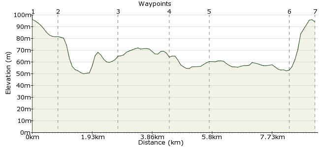
Ascent
43m (141ft)
Descent
45m (147ft)
Max. Elevation
100m (328ft)
Altitude Gain & Loss
88m (288ft)
Start & End
Seend
Distance
9.20km
(5.72mi)
(5.72mi)
Duration
~2:45h
Difficulty
Leisurely
Is Wiltshire our most underrated walking county? In my opinion, it probably is. I may be biased - Wiltshire born and bred - but the mix of chalk hills, canals, riversides and good pubs provides everything the leisurely walker needs. This trek around the hilltop village of Seend makes an excellent half-day's walk, leaving plenty of time to enjoy the good pubs on route. Suitable for families, but note one major road needs crossing.
Walk Functions
Share
Nearby Walks
Steeple Ashton stroll
A leisurely, circular walk (countryside) starting in Wiltshire, England, about 5.40km (3.36 mi) long, duration: ~1:30h.Imber village
A moderate, linear walk (countryside) starting in Wiltshire, England, about 15.70km (9.76 mi) long, duration: ~5:00h.Kennet and Avon exploration
A moderate, circular walk (canal) starting in Wiltshire, England, about 11.60km (7.21 mi) long, duration: ~3:30h.Walk Map
- $walk->POI array(0)
Waypoints
OS Grid ST943610
Take the bus to Seend (links from Trowbridge and Devizes). At the church, take the footpath heading south down from the ridge.
OS Grid ST951610
At the first footpath junction, turn left towards Turner's Farm. From here, follow the path heading down into the valley.
About 0.82 km (~0.51 miles) from 
OS Grid ST966599
Cross Summerham Brook and continue towards Poulshot. Just before the village, turn left to head along the path heading north.
About 1.90 km (~1.18 miles) from 
OS Grid ST968615
Cross the A361 carefully to reach the White Horse Trail.
About 1.64 km (~1.02 miles) from 
OS Grid ST956619
Cross the Kennet & Avon canal at the bridge and follow the path alongside it through Martinslade.
About 1.26 km (~0.78 miles) from 
OS Grid ST932613
The path leads to Seend Cleeve, at the base of the hill on which Seend sits. The Barge Inn is a good spot for a canalside pint: www.bargeinnseend.co.uk
About 2.50 km (~1.55 miles) from 
 Seend again
OS Grid ST939609
Take the path uphil into Seend for the bus home.
About 0.85 km (~0.53 miles) from 
