Allsop Moor to Earl Sterndale via Hartington
A moderate walk (countryside) in national park Peak District starting and finishing in Derbyshire, England, about 16.30km (10.13 mi) long with an estimated walking time of about 5:15h. It is unsuitable for families with children, prams & pushchairs, wheelchairs.
Elevation Profile
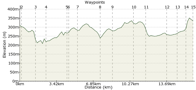
Ascent
238m (780ft)
Descent
213m (698ft)
Max. Elevation
360m (1181ft)
Altitude Gain & Loss
451m (1478ft)
Start
Alsop Moor
End
Earl Sterndale
Distance
16.30km
(10.13mi)
(10.13mi)
Duration
~5:15h
Difficulty
Moderate
Ordnance Survey Map
 Created by dcbwhaley on 16 Aug 2014
A pleasant walk through some of the less frequented Derbyshire Dales visiting the popular village of Hartington.
The 442 bus (Buxton to Ashbourne) is used to access both start and finish. The walk can be shortened by catching the bus at Crowdecite.
Most of the walk is on limestone which can be slippery in the wet
Walk Functions
Share
Nearby Walks
Derbyshire delights in Dovedale
A moderate, linear walk (riverside) starting in Derbyshire, England, about 14.90km (9.26 mi) long, duration: ~4:30h.Hartington to Wolfscotedale
A leisurely, circular walk (riverside) starting in Derbyshire, England, about 8.90km (5.53 mi) long, duration: ~2:45h.Two rivers - the Dove and the Manifold
A moderate, circular walk (countryside) starting in Derbyshire, England, about 15.70km (9.76 mi) long, duration: ~5:15h.Walk Map
- $walk->POI array(0)
Waypoints
OS Grid SK158565
Debus at Allsop Moor, where the minor road from Biggin joins the A515
OS Grid SK157567
Walk along the minor road, under the bridge - The Tissington Trail - to a signpost on the left
About 0.17 km (~0.11 miles) from 
OS Grid SK146561
Walk down the rather rough unnamed dry dale into Dovedale
About 1.34 km (~0.83 miles) from 
OS Grid SK141569
Turn right and follow the good path until a prow of rock marks the junction of Wolfcote Dale and Biggin Dale
About 0.96 km (~0.6 miles) from 
OS Grid SK145587
Cross the wall and turn right (sp BIggin). Walk up the dale until a signpost is reached.
About 1.81 km (~1.12 miles) from 
OS Grid SK144588
Turn left (sp Hartington), cross a wall and walk a short distance to another signpost
About 0.17 km (~0.11 miles) from 
OS Grid SK148595
Ignore the well worn path on the left and remain in the dale (sp Biggin). Continue up the dale to reach a metalled road at Dale End
About 0.77 km (~0.48 miles) from 
OS Grid SK129604
Turn left on the road and quickly turn left again onto a track which joins a road near the Youth Hostel. Go down the hill to Hartington.
About 2.09 km (~1.3 miles) from 
OS Grid SK129615
The route continues straight on past the Church but you might want to turn left to visit Hartington. Then follow the road up the hill until a signed path goes off to the left on a right hand bend.
About 1.16 km (~0.72 miles) from 
OS Grid SK124633
Follow the well marked path - blue waymarks and sp Pilsbury/Crowdecote - until you reach the junction with the Pilsbury path which runs in a small dale.
About 1.87 km (~1.16 miles) from 
OS Grid SK115639
Turn left on the Pisbury path and follow it, crossing a metalled road, to Pilsbury Castle.
(Pilsbury Castle can be reached more easily by following the minor Road from Hartington to Pilsbury)
About 1.12 km (~0.7 miles) from 
OS Grid SK101651
After examining the Castle take the path near the river. Then through Bridge End Farm to the road at Crowdecote.
If time is pressing the bus can be caught here
About 1.87 km (~1.16 miles) from 
OS Grid SK095659
Go up the road for a short distance then turn left on the Earl Sterndale road. Then take the track through Meadow Farm and continue to Green Lane
About 0.97 km (~0.6 miles) from 
OS Grid SK089663
Cross Green Lane and follow the road towards Underhill. After the farm it becomes a track. In the yard of the next cottage a sign on the right points the way to Earl Sterndale
About 0.70 km (~0.43 miles) from 
 Earl Sterndale.
OS Grid SK090670
Go through the gate and climb the steep flank of Hitter Hill. A sign at the top shows the way down. Turn left at the Quiet Women public house for the bus stop.
About 0.71 km (~0.44 miles) from 
