The Wagon Way
A leisurely walk (coast) in Cumbria, England, about 4.50km (2.80 mi) long with an estimated walking time of about 1:15h. It is suitable for families with children, but unsuitable for prams & pushchairs, wheelchairs.
Elevation Profile
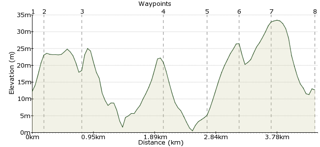
Ascent
38m (124ft)
Descent
38m (124ft)
Max. Elevation
40m (131ft)
Altitude Gain & Loss
76m (248ft)
Start & End
Whitehaven
Distance
4.50km
(2.8mi)
(2.8mi)
Duration
~1:15h
Difficulty
Leisurely
Ordnance Survey Map
This coastal walk follows the route of a disused railway that is part of the National Cycle Network. The name comes from the wagons that used to transport goods to and from Parton. Now a quiet village, it used to have a glassworks, tannery, brewery, colliery, salt-pan and ironworks. Few people visiting the Lakes make it out to the coastline, but it's worth taking the time to venture out here to discover a little more about the region's history.
Walk Functions
Share
Nearby Walks
Pillar from Ennerale
A hard, circular walk (mountain (above 600m)) starting in Cumbria, England, about 40.00km (24.85 mi) long, duration: ~15:15h.St Bees and its lighthouse
A moderate, circular walk (coast) starting in Cumbria, England, about 11.10km (6.90 mi) long, duration: ~3:30h.A cross-valley walk - Buttermere to Seatoller
A moderate, linear walk (mountain (above 600m)) starting in Cumbria, England, about 17.10km (10.63 mi) long, duration: ~7:45h.Walk Map
- $walk->POI array(0)
Waypoints
OS Grid NX974187
Take the train to Whitehaven station on the Cumbrian Coast Line. There are good bus connections to the town as well.
OS Grid NX974189
The Wagon Way passes by the station. Look for the signposts to point you towards it (also called National Cycle Network 72).
About 0.14 km (~0.09 miles) from 
OS Grid NX973194
The Wagon Way follows the route of an old disused railway that used to transport coal and goods to and from Parton.
About 0.53 km (~0.33 miles) from 
OS Grid NX979205
At Parton, turn left to go under the railway bridge.
About 1.28 km (~0.8 miles) from 
OS Grid NX979211
Take the footbridge over the beck and follow the riverside to the road.
About 0.62 km (~0.39 miles) from 
OS Grid NX983213
At the end of Foundry Road, turn right to pass the church and the site of a Roman fort.
About 0.43 km (~0.27 miles) from 
OS Grid NX983208
At Morseby Hall, cut over the field across to Parton again.
About 0.44 km (~0.27 miles) from 
 Parton station
OS Grid NX978204
Back at the station, you can rejoin the Cumbrain Coastal Line to Whitehaven or stations further afield. There are a couple of pubs nearby.
About 0.64 km (~0.4 miles) from 
