Castletown & the Langness Peninsular
A moderate walk (coast) in Isle of Man, Isle of Man, about 10.60km (6.59 mi) long with an estimated walking time of about 3:00h. It is suitable for families with children, but unsuitable for prams & pushchairs, wheelchairs.
Elevation Profile
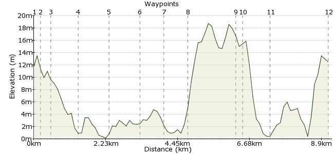
Ascent
27m (88ft)
Descent
26m (85ft)
Max. Elevation
20m (65ft)
Altitude Gain & Loss
53m (173ft)
Start & End
Castletown Market Square
Distance
10.60km
(6.59mi)
(6.59mi)
Duration
~3:00h
Difficulty
Moderate
Ordnance Survey Map
 2Created by mac.hawk on 26 Dec 2014
Very regular bus service to Castletown Market Square from Douglas/Port Erin. A very flat coastal circular walk along road, track, footpath (& shore should you choose the option) from Castletown taking in the Langness Peninsular. Lovely views across Castletown Bay, Derby Haven & inland to South Barrule. Look out for varied bird life and seals.
Oddly, Langness is not included on the Raad ny Foillan (Way of the Gull) IOM long distance coastal walk.
Walk Functions
Share
Nearby Walks
Castletown, Silverdale Glen and coastal path
A moderate, circular walk (riverside) starting in Isle of Man, Isle of Man, about 11.40km (7.08 mi) long, duration: ~3:15h.Port Erin Amble
A leisurely, circular walk (coast) starting in Isle of Man, England, about 5.50km (3.42 mi) long, duration: ~2:00h.Port Soderick to Douglas along Marine Drive
A leisurely, linear walk (coast) starting in Isle of Man, Isle of Man, about 7.10km (4.41 mi) long, duration: ~2:00h.Walk Map
- $walk->POI array(0)
Waypoints
OS Grid SC263673
Castletown is serviced by a number of regular bus services. Alight in the market square and walk down Castle Street. Turn right at the first junction the take the footbridge over the river.
OS Grid SC265675
Once over the river turn right along Bridge Street, which soon veers left and becomes Douglas Street initially following the sea wall. At the first junction veer right into College Green.
About 0.22 km (~0.14 miles) from 
OS Grid SC268677
Follow College Green until it rejoins the sea wall & becomes The Promenade (from this point it's safe to walk the beach if the tide is out). Pass King William college on the left.
About 0.38 km (~0.24 miles) from 
OS Grid SC278677
The road becomes Derbyhaven Road. Reach a parking area on the right, enter, turn left & follow the shingle footpath between shore and golf course.
About 0.98 km (~0.61 miles) from 
OS Grid SC284670
The shingle path runs for over half a mile to join a tarmac road where you turn right and follow it heading towards the Herring Tower & lighthouse.
About 1.00 km (~0.62 miles) from 
OS Grid SC283659
At the car park the tarmac turns to track beyond which are numerous tracks around the headland. Veer right and follow the shoreline path to Langness Point.
About 1.04 km (~0.65 miles) from 
OS Grid SC277652
Continue along the footpath as it follows the shore line south (seaward) around the lighthouse and continues following the Langness eastern shoreline.
About 0.89 km (~0.55 miles) from 
OS Grid SC285656
It's a short detour to visit the Herring Tower and the trig pillar before continuing to follow the cliff top edge with the golf course on your left heading towards the clubhouse.
About 0.82 km (~0.51 miles) from 
OS Grid SC291671
Reach the road beyond the clubhouse and turn right to visit St Michael's chapel and Derby Fort on St Michael's Island before retuning back to the clubhouse.
About 1.64 km (~1.02 miles) from 
OS Grid SC290670
Continue along Fort Island Road following the shoreline on the right into Derbyhaven (you can walk the beach if the tide is out).
About 0.12 km (~0.07 miles) from 
OS Grid SC283676
At the road junction turn left into Derbyhaven Road and follow it to pass King William's College again (now on your right) and retrace your route back to the Market Square in Castletown.
About 0.94 km (~0.58 miles) from 
 Castletown Market Square (2)
OS Grid SC262674
The walk's roughly 8 miles long. No facilities once you've left Castletown.
About 2.08 km (~1.29 miles) from 
