Arnside to Leighton Moss
A leisurely walk (countryside) in Cumbria, England, about 8.00km (4.97 mi) long with an estimated walking time of about 2:15h. It is unsuitable for families with children, prams & pushchairs, wheelchairs.
Elevation Profile
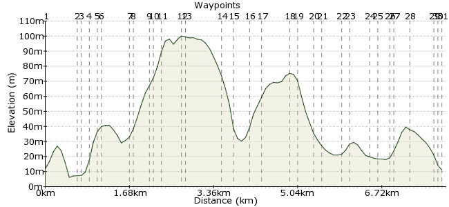
Ascent
153m (501ft)
Descent
153m (501ft)
Max. Elevation
0m (0ft)
Altitude Gain & Loss
306m (1002ft)
Start & End
Arnside
Distance
8.00km
(4.97mi)
(4.97mi)
Duration
~2:15h
Difficulty
Leisurely
Ordnance Survey Map
A lovely walk that takes to around Arnside Knott and across Silverdale to The RSPB reserve at Leighton Moss.
Walk Functions
Share
Nearby Walks
Arnside Knott and Morecambe Bay
A leisurely, linear walk (countryside) starting in Cumbria, England, about 9.60km (5.97 mi) long, duration: ~3:15h.Scouting around Kendal
A moderate, circular walk (countryside) starting in Cumbria, England, about 12.70km (7.89 mi) long, duration: ~4:30h.Morecambe Bay and Heysham
A leisurely, linear walk (coast) starting in Lancashire, England, about 6.30km (3.91 mi) long, duration: ~1:45h.Walk Map
- $walk->POI array(0)
Waypoints
OS Grid SD460788
Leave the station turn right and cross the road onto the pavement heading into Arnside. The pavement bends round to the left taking you along the Promenade past a range of shops on your left.
OS Grid SD453786
Go through the gate and turn left to head up hill on a path leading into Ash Meadow Woods. The path soon levels out and you need to take a right turn to follow a green arrow which takes you on a path
About 0.70 km (~0.43 miles) from 
OS Grid SD453786
Go through the gate and turn left to head up hill on a path leading into Ash Meadow Woods. The path soon levels out and you need to take a right turn to follow a green arrow.
About 0.00 km (~0 miles) from 
OS Grid SD452784
This path comes on to a tarmac road / drive way. Turn left to head up hill - you pass a turret on your left and the first house you pass on your left is number 12 'The Pines'.
About 0.20 km (~0.12 miles) from 
OS Grid SD453783
The road you meet is Red Hills Road. Cross over onto the pavement and turn right. After a short distance there is a house which typically has a stall selling home made preserves - the fudge is worth
About 0.12 km (~0.07 miles) from 
OS Grid SD453783
The road you meet is Red Hills Road. Cross over onto the pavement and turn right. After a short distance there is a house which typically has a stall selling home made preserves
About 0.00 km (~0 miles) from 
OS Grid SD450779
On your left there is a road which you need to take - there is a sign saying 'The Knott'. Head up the hill - the first house you pass on your right has a sign saying 'Bridleway B&B'.
About 0.53 km (~0.33 miles) from 
OS Grid SD451778
Continue up the hill past houses and you come to a National Trust sign on the left sign of the road for 'Arnside Knott'. Twenty metres after the sign go through the kissing gate on your right.
About 0.06 km (~0.04 miles) from 
OS Grid SD451775
Immediately turn left to head up hill on a grass path which runs roughly parallel to the road that you have just left. The path comes to a kissing gate which you go through and turn right.
About 0.30 km (~0.19 miles) from 
OS Grid SD450775
go through another gate next to a cattle grid which takes you onto an unmade up road. Follow this around - you do not turn left and go to the Knott.
About 0.03 km (~0.02 miles) from 
OS Grid SD449774
As you bend round to the left you arrive in an area for cars to park - don't go into the car park instead follow the path to the left of the car parking still skirting around the Knott.
About 0.17 km (~0.11 miles) from 
OS Grid SD451770
After about 20 metres you go through a gate and then after another 80 metres you go through another gate. The path you want to take is signposted to 'Arnside Tower'. Keep following the signs to Arns
About 0.37 km (~0.23 miles) from 
OS Grid SD451770
After about 20 metres you go through a gate and then after another 80 metres you go through another gate. The path you want to take is signposted to 'Arnside Tower'.
About 0.00 km (~0 miles) from 
OS Grid SD458769
On crossing the road you head down a drive way towards a farm. Follow the signs through the farm yard bearing left after going through the gate out of the farm yard.
About 0.72 km (~0.45 miles) from 
OS Grid SD458768
head up past the remains of Arnside Tower – signposted to 'Elmslack'. On passing the tower go over a ladder style and take the path straight on through the woods still signposted 'Elmslack'.
About 0.14 km (~0.09 miles) from 
OS Grid SD460766
Soon you emerge from the woods into a campsite – continuing in roughly the same direction on the footpath which takes you through the campsite.
About 0.25 km (~0.16 miles) from 
OS Grid SD458763
You go into some more woods heading away from the campsite. Continue on this path and you come to a stone stile which you go through, carrying on walking.
About 0.28 km (~0.17 miles) from 
OS Grid SD460759
After a while there is a fence on your right hand side as you start to head down hill. After going through a second stone stile you soon come out of the woods on to a tarmacked road passing houses
About 0.40 km (~0.25 miles) from 
OS Grid SD461759
After about 100 metres walking on the road there is a signpost right to 'Cove Road'. This path takes you between two stone walls and houses – you continue on to 'Wallings Lane'
About 0.11 km (~0.07 miles) from 
OS Grid SD459757
Go through a gate and past a house called 'Broomhill' on to a road with another sign saying 'Wallings Lane' – go left following the road down the hill. When you meet a road – 'Cove Road' - turn left
About 0.22 km (~0.14 miles) from 
OS Grid SD461756
After about 30 metres there is a path next to the road which goes between hedges and then with a wall on the left. When this path emerges turn right onto 'Townsfield' walking towards the church spire
About 0.12 km (~0.07 miles) from 
OS Grid SD463754
The road passes some houses and then turns into a path keep going until you meet a road. You will see St John's Church over the other side of the road, cross and go around the church on the left
About 0.36 km (~0.22 miles) from 
OS Grid SD464753
When you get to the back of the church go through the wooden gate.
7 – On going through the gate you need to turn right and then very shortly left – taking the path signed posted to 'Bottoms Lane'
About 0.10 km (~0.06 miles) from 
OS Grid SD467754
After 20 metres you go between two stones into a field. Carry on through the field going through little white kissing gate and continue on ahead over the fields towards a five bar gate to the road
About 0.33 km (~0.21 miles) from 
OS Grid SD468755
Turn right when you reach the road and walk for about 20 metres until there is a kissing gate on your left with a sign to 'The Row'. Go through this gate into a field
About 0.16 km (~0.1 miles) from 
OS Grid SD470755
After about 30 metres there is a stile in the wall on your right which we need to go through. Go roughly straight ahead just to the right of the three trees – you will eventually a wooden gate ahead.
About 0.14 km (~0.09 miles) from 
OS Grid SD470755
Go through this gate into another field and straight on to another gate which takes you to a road. At the road – The Row – take a right and head initially up hill – with a sign to the train station
About 0.08 km (~0.05 miles) from 
OS Grid SD473753
Carry on you go past Bank Well Reserve on your right. Follow the road and you come to a golf course on your left – ignore the path over the golf course as there are a lot of hidden tees.
About 0.30 km (~0.19 miles) from 
OS Grid SD475749
Stay on the road past 'Myers Allotment Reserve' until it comes to another road. Turn left on this road – taking care as it can be busy with cars. Go past the front of the golf club
About 0.41 km (~0.25 miles) from 
OS Grid SD476750
Cross the road to take the road down hill to Leighton Moss which is soon on the right side of the road. A wonderful RSPB reserve which is half-price entry if you came via public transport or by bike!
About 0.09 km (~0.06 miles) from 
 Leighton Moss
OS Grid SD476749
There is a cafe upstairs. Silverdale train station is close by – go back to the top of the road you turned down towards Leighton Moss and go right (you previously came from the left).
About 0.04 km (~0.02 miles) from 
