Buckden Circular
A moderate walk (countryside) in national park Yorkshire Dales in North Yorkshire, England, about 10.50km (6.52 mi) long with an estimated walking time of about 3:15h. It is suitable for families with children, but unsuitable for prams & pushchairs, wheelchairs.
Elevation Profile
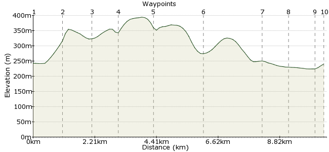
Ascent
127m (416ft)
Descent
130m (426ft)
Max. Elevation
400m (1312ft)
Altitude Gain & Loss
257m (842ft)
Start & End
Buckden, Yorkshire
Distance
10.50km
(6.52mi)
(6.52mi)
Duration
~3:15h
Difficulty
Moderate
Ordnance Survey Map
 2Created by mac.hawk on 05 Dec 2015
A 12 mile circular route from Buckden along well defined RoW's.
Buckden is served Mon-Sat by regular buses from Ilkley & Skipton (No's 72 & 72R) & on Sundays by Dalesbus from Wakefield/Leeds. Public toilets at Buckden. Pubs in Buckden, Cray & Hubberholme. Church in Hubberholme features Robert Thompson's 'mouse' artwork on some of the pews.
Walk Functions
Share
Nearby Walks
Bucken Circular - Up and Over & Return
A moderate, circular walk (low hills and fells (below 600m)) starting in North Yorkshire, England, about 16.90km (10.50 mi) long, duration: ~6:45h.Great Whernside and Cam Head
A moderate, circular walk (low hills and fells (below 600m)) starting in North Yorkshire, England, about 11.20km (6.96 mi) long, duration: ~4:45h.Cam Head and Buckden Pike
A moderate, circular walk (low hills and fells (below 600m)) starting in North Yorkshire, England, about 16.10km (10.00 mi) long, duration: ~6:00h.Walk Map
- $walk->POI array(0)
Waypoints
OS Grid SD942772
The walk starts from the YDNPA Car Park in Buckden (the Bus Stop is here too). Head north along an obvious footpath that climbs relatively gently uphill and pass through a lightly wooded area.
OS Grid SD938782
The bridleway veers right & follow it (ignoring the path at right that heads uphill to Buckden Pike) for 1/2 mile to take a path on the left that heads downhill towards the White Lion pub at Cray.
About 1.07 km (~0.66 miles) from 
OS Grid SD942792
The wayposted footpath runs around the back of the pub and follow it as it veers right and climbs uphill gently to reach a footbridge over Crook Gill.
About 1.04 km (~0.65 miles) from 
OS Grid SD933791
Once over the footbridge follow the RoW footpath that runs along the lip of the hill to Scar House. There are excellent views down the head of the Wharfe Valley along this section.
About 0.87 km (~0.54 miles) from 
OS Grid SD921789
The footpath continues in similar vein beyond Scar House through a number of fields to Little House whereafter it descends, initially through woodland, to the farm at Yockenthwaite.
About 1.26 km (~0.78 miles) from 
OS Grid SD904790
At Yockenthwaite you can either follow the north bank of the river or the minor road east (left) for approx 1 3/4 miles to the hamlet of Hubberholme.
About 1.62 km (~1.01 miles) from 
OS Grid SD925782
At Hubberholme The George Inn & the Church of St Michael & All Angels are both worth a visit. Follow the road for 1/2 mile & a waypost on the left indicates following a RoW footpath to the river bank.
About 2.19 km (~1.36 miles) from 
OS Grid SD933779
The footpath soon joins the river bank and follow it downstream for 3/4 mile to reach the road that is Dubb's Lane.
About 0.84 km (~0.52 miles) from 
OS Grid SD938773
At the road turn left and follow it briefly back into Buckden.
About 0.84 km (~0.52 miles) from 
 Buckden (2)
OS Grid SD942771
The walk is approx 12 miles. Pub & Tea Room's usually available for refreshments.
About 0.39 km (~0.24 miles) from 

1 comment... join the discussion!
mac.hawk
NYCC cuts in subsidies for public transport will result in changes to the 72 & 72R services from April 2016. It is currently looking like a Skipton-Grassington service will continue Mon-Sat. Services from Ilkley to Grassington, along with all services from Grassington to Kettlewell/Buckden being on a demand responsive basis. See http://www.friendsofdalesbus.org.uk/#/latest-news/4590022137/North-Yorkshire-Bus-Subsidy-Cut-Proposals/10205989 for details.