Llanfairfechan to Penrhyn Castle
A moderate walk (coast) starting and finishing in Clwyd, Wales, about 10.10km (6.28 mi) long with an estimated walking time of about 3:00h. It is suitable for families with children, but unsuitable for prams & pushchairs, wheelchairs.
Elevation Profile
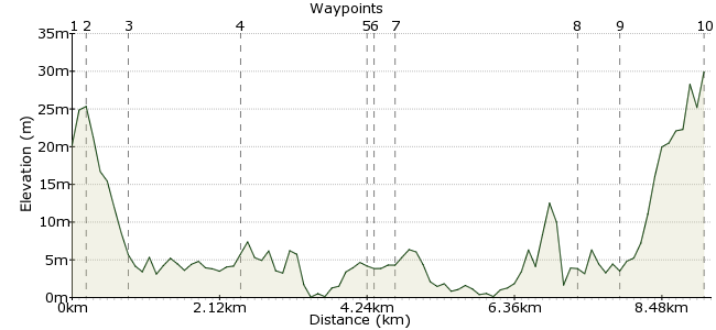
Ascent
38m (124ft)
Descent
28m (91ft)
Max. Elevation
30m (98ft)
Altitude Gain & Loss
66m (215ft)
Start
Llanfairfechan
End
Bangor
Distance
10.10km
(6.28mi)
(6.28mi)
Duration
~3:00h
Difficulty
Moderate
Ordnance Survey Maps
 1Created by driver 16 on 23 Jan 2016
At last, fine weather forecast, too windy for cycling though, so, after 3 months, thought I would ease myself back into serious walking with this easy low level walk along the south bank of the Menai Straight on concrete prom, grassy banks, small sections of shingle beach and tarmac, with views over Llandudno, Anglesey, Penrhyn Castle, through / past 6 nature reserves, twitchers take binoculars
Walk Functions
Share
Nearby Walks
Llanfairfechan
A leisurely, circular walk (coast) starting in Clwyd, Wales, about 5.60km (3.48 mi) long, duration: ~1:45h.History in the hills of Conwy
A moderate, linear walk (low hills and fells (below 600m)) starting in Clwyd, Wales, about 12.30km (7.64 mi) long, duration: ~5:00h.Aber Falls
A leisurely, circular walk (riverside) starting in Clwyd, Wales, about 1.80km (1.12 mi) long, duration: ~0:30h.Walk Map
- $walk->POI array(0)
Waypoints
OS Grid SH679746
Well served by Arriva Buses Wales Service X5, a linear walk that can be done from either end, but, would suggest an early start from Llanfairfechan with lunch in Penrhyn Castle (check N.T. opening).
OS Grid SH680748
Go left downhill on Station Road, stream on left, under railway to Pavilion Café on promenade.
About 0.23 km (~0.14 miles) from 
OS Grid SH679754
Turn left on promenade, cross bridge over stream, see boating lake with childrens' play area behind, very straightforward and well waymarked, on concrete prom leading onto grassy banks.
About 0.62 km (~0.39 miles) from 
OS Grid SH666742
Cross and bear right, then left at corner of slate fencing,
About 1.70 km (~1.06 miles) from 
OS Grid SH649735
Cross and walk on boardwalk, follow path to carpark, turn left under metal barrier, turn right onto "PRIVATE DRIVE", "FOOTPATH ONLY"
About 1.91 km (~1.19 miles) from 
OS Grid SH648734
Follow to where track ends with descent onto foreshore (good idea to check tide times as could affect shingle beach), only a few hundred yards and climb back onto grassy bank, follow to kissing gate.
About 0.09 km (~0.06 miles) from 
OS Grid SH647731
Go right onto enclosed path on top of cliffs, climbing gently, PLEASE WATCH CHILDREN, 4 areas of soil erosion onto path.
About 0.38 km (~0.24 miles) from 
OS Grid SH618725
Kissing gate, turn right, then left and take 11 steps down to beach (again CHECK TIDE TIMES), to exit beach at Aber-Ogwen carpark.
About 2.87 km (~1.78 miles) from 
OS Grid SH613722
Turn left, walk along and stay on tarmac road passing Spinnies Nature Reserve, over railway bridge to T junction.
About 0.56 km (~0.35 miles) from 
 T JUNCTION / END OF WALK
OS Grid SH609710
Turn right, I've already been to Penrhyn Castle, so, caught bus at 1st. bus stop on right, but, if you want to visit Penrhyn Castle for lunch / to explore, stay on this road to entrance by roundabout.
About 1.32 km (~0.82 miles) from 

1 comment... join the discussion!
driver 16
Apologies to readers, think I made a mistake labelling Waypoint 4 Wooden Bridge, think it should read Small Flat Concrete Bridge, will be clear on my Album at Flickr.