Plumpton Rocks - Wetherby to Follifoot
A moderate walk (countryside) starting and finishing in Leeds, England, about 11.50km (7.15 mi) long with an estimated walking time of about 3:30h. It is suitable for families with children, but unsuitable for prams & pushchairs, wheelchairs.
Elevation Profile
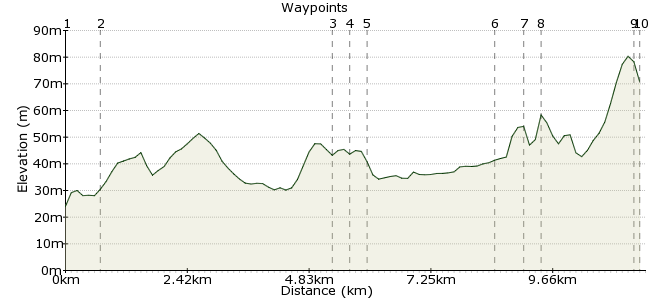
Ascent
68m (223ft)
Descent
21m (68ft)
Max. Elevation
90m (295ft)
Altitude Gain & Loss
89m (291ft)
Start
Wetherby Bus Station
End
Follifoot
Distance
11.50km
(7.15mi)
(7.15mi)
Duration
~3:30h
Difficulty
Moderate
Ordnance Survey Map
 2Created by mac.hawk on 24 Feb 2016
Plumpton Rocks, what a wonderful site. Fantastic rock formations inside a wonderful woodland. It's private land so there is an admission charge but it's well worth the money, pre-high school kids will love it.
This is a mainly flat walk, initially along the route of an old railway line.
Follifoot currently has a Mon-Sat hourly service - 770 Leeds to Harrogate (07.30 to 18.30).
Walk Functions
Share
Nearby Walks
Wetherby Circular via Thorp Arch
A leisurely, circular walk (countryside) starting in West Yorkshire, England, about 9.10km (5.65 mi) long, duration: ~2:30h.Follifoot to Spofforth via Plumpton Rocks
A leisurely, circular walk (countryside) starting in North Yorkshire, England, about 6.40km (3.98 mi) long, duration: ~1:45h.Roundhay Park Ramble
A leisurely, circular walk (city/town) starting in Leeds, England, about 4.40km (2.73 mi) long, duration: ~1:15h.Walk Map
- $walk->POI array(0)
Waypoints
OS Grid SE403480
Alight at the bus station & turn left up High Street then ahead into North Street & finally into Deighton Road shortly after which take the wayposted track on the left onto the old railway line.
OS Grid SE405487
Simply follow the old railway line (a section of the Harland Way) a little over 3 miles to Spofforth village.
About 0.73 km (~0.45 miles) from 
OS Grid SE364507
Where the track leads to the road carry on ahead to soon reach the main road junction and turn right (or carry on ahead to reach the Castle ruins before returning here).
About 4.60 km (~2.86 miles) from 
OS Grid SE362509
Follow the road as it passes All Saints Church on the left, crosses Crimple Beck then take the access point on the left and follow the beck upstream.
About 0.26 km (~0.16 miles) from 
OS Grid SE365511
Follow the beck upstream for 1 1/2 miles until you approach a minor road.
About 0.34 km (~0.21 miles) from 
OS Grid SE349530
When you get near the road turn right and follow the edge of Brown Hill Wood (on your left) to soon reach the A661 road.
About 2.48 km (~1.54 miles) from 
OS Grid SE352534
At the A661 turn right briefly to reach the entrance to Plumpton Rocks on the left.
About 0.45 km (~0.28 miles) from 
OS Grid SE355535
A short way up the drive find the entrance to Plumpton Rocks on the left. An admission fee is payable (see their website for details) and begin the adventure, younger children will love it!
About 0.33 km (~0.21 miles) from 
OS Grid SE341525
After wandering the delights of Plumpton Rocks return to Crimple Beck and take the road SW to Follifoot.
About 1.71 km (~1.06 miles) from 
 Return Bus
OS Grid SE341524
The walk is approx 7 1/2 miles excluding any mileage undertaken in/around Plumpton Rocks - I'd add at least a mile.
About 0.16 km (~0.1 miles) from 
