Around Bodham and Holt
A leisurely walk (countryside) in Norfolk, England, about 6.30km (3.91 mi) long with an estimated walking time of about 1:45h. It is unsuitable for families with children, prams & pushchairs, wheelchairs.
Elevation Profile
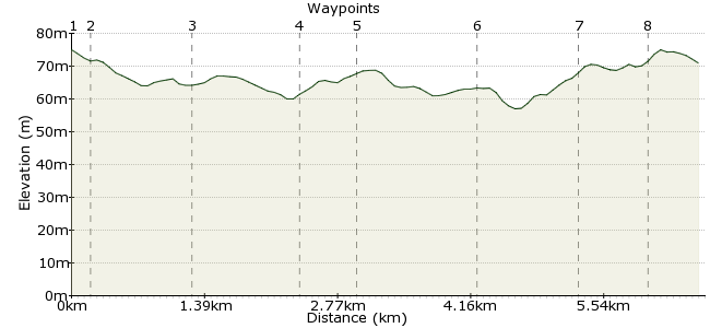
Ascent
18m (59ft)
Descent
21m (68ft)
Max. Elevation
80m (262ft)
Altitude Gain & Loss
39m (127ft)
Start & End
Bodham, North Norfolk, Norfolk, England, NR25
Distance
6.30km
(3.91mi)
(3.91mi)
Duration
~1:45h
Difficulty
Leisurely
Ordnance Survey Maps
A rural walk in north Norfolk, with good bus connections. The perfect change of scenery if you are staying on the coast and fancy something different.
Walk Functions
Share
Nearby Walks
Sheringham walk
A moderate, circular walk (countryside) starting in Norfolk, England, about 9.60km (5.97 mi) long, duration: ~3:00h.Blakeney Point on the Norfolk Coast
A leisurely, linear walk (coast) starting in Norfolk, England, about 8.00km (4.97 mi) long, duration: ~2:15h.East and West Runton
A leisurely, walk (coast) starting in Norfolk, England, about 4.60km (2.86 mi) long, duration: ~1:15h.Walk Map
- $walk->POI array(0)
Waypoints
OS Grid TG125402
Start the walk at Bodham, near Holt.
OS Grid TG123402
Heading west out of the village, take the track heading south.
About 0.22 km (~0.14 miles) from 
OS Grid TG120392
Continue to the manor house, then continue heading south for a short distance on the road.
About 1.04 km (~0.65 miles) from 
OS Grid TG120380
Continue south along the footpath to reach the remains of Baconsthorpe Castle: www.english-heritage.org.uk/visit/places/baconsthorpe-castle
About 1.16 km (~0.72 miles) from 
OS Grid TG114379
Continue towards the village and take the right fork towards Beckett's Farm.
About 0.57 km (~0.35 miles) from 
OS Grid TG106388
The path heads north towards the edge of a plantation. There's a short stretch along a road here, so take care.
About 1.26 km (~0.78 miles) from 
OS Grid TG102399
Continue into High Kelling, from where it's a short walk to either Bodham or into Holt.
About 1.10 km (~0.68 miles) from 
 Kelling Hospital
OS Grid TG096396
The bus stops here, for the end of the walk.
About 0.70 km (~0.43 miles) from 
