Lea Valley New River walk
A leisurely walk (riverside) in City of London, England, about 4.90km (3.04 mi) long with an estimated walking time of about 1:15h. It is suitable for families with children, prams & pushchairs, wheelchairs.
Elevation Profile
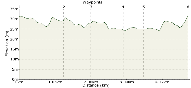
Ascent
8m (26ft)
Descent
8m (26ft)
Max. Elevation
40m (131ft)
Altitude Gain & Loss
16m (52ft)
Start & End
Broxbourne Railway Station
Distance
4.90km
(3.04mi)
(3.04mi)
Duration
~1:15h
Difficulty
Leisurely
Ordnance Survey Map
An easy but fascinating waterside walking near London. This route follows part of the New River, an artificial waterway dug in the 17th century to supply an ever expanding City of London with fresh drinking water.
This is one of Walk London's network of walks: www.walklondon.org.uk.
You can get a more detailed route plan on their website. This route sometimes changes, so check for updates of the route:
www.walklondon.org.uk/
uploads/File/routes/New_River_Walk.pd
Walk Functions
Share
Nearby Walks
A walk through Epping Forest
A leisurely, linear walk (woodland) starting in Essex, England, about 8.70km (5.41 mi) long, duration: ~2:45h.The Pymmes Brook Trail
A moderate, linear walk (city/town) starting in City of London, England, about 16.40km (10.19 mi) long, duration: ~4:30h.The end of the line...but worth it!
A leisurely, circular walk (countryside) starting in City of London, England, about 6.20km (3.85 mi) long, duration: ~1:45h.Walk Map
- $walk->POI array(0)
Waypoints
OS Grid TL374072
From the station, take the footpath heading north.
OS Grid TL376085
Where the path turns right, look across the lake. In the warm, summer evenings, between late May and August, you can see bats swooping over the surface of the water in search of insects. This
lake is one of the best feeding sites for bats in the Lee Valley.
About 1.30 km (~0.81 miles) from 
OS Grid TL384082
Dobbs Weir is a favourite spot for fishing. You can picnic, go to the cafe or visit the Fish and Eels Public House, overlooking the weir. From June to August you can look out for the bright blue flash of Banded Demoiselle damselflies.
About 0.79 km (~0.49 miles) from 
OS Grid TL385073
Follow the path down to Nazeing Mead, a feeding site for Mediterranean Gulls and Terns.
About 0.87 km (~0.54 miles) from 
OS Grid TL383069
The path takes you through the ‘mystical’ living tunnel, a complete contrast to the open view of the lakes at Nazeing Meads.
About 0.51 km (~0.32 miles) from 
 The Old Mill and Meadows
OS Grid TL371068
A mill had stood on the site for over 900 years, until a massive fire destroyed it in 1949. Look down at the millrace and you will see the restored mill wheel and old machinery. Follow the Lee Valley line markers and finger posts over the Mill Stream and back to Broxbourne station.
About 1.22 km (~0.76 miles) from 
