The south side of Salisbury Plain
A moderate walk (countryside) starting and finishing in Wiltshire, England, about 13.90km (8.64 mi) long with an estimated walking time of about 4:30h. It is unsuitable for families with children, prams & pushchairs, wheelchairs.
Elevation Profile
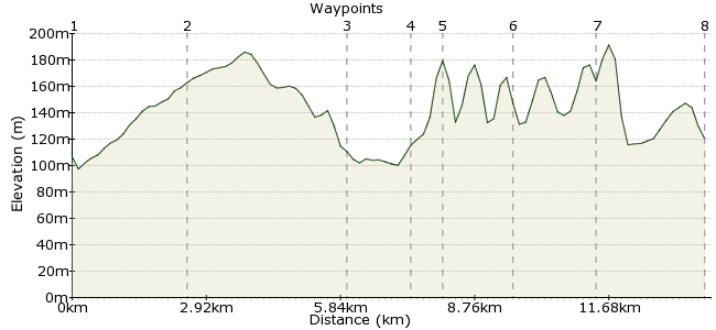
Ascent
123m (403ft)
Descent
109m (357ft)
Max. Elevation
200m (656ft)
Altitude Gain & Loss
232m (760ft)
Start
Chitterne
End
Warminster
Distance
13.90km
(8.64mi)
(8.64mi)
Duration
~4:30h
Difficulty
Moderate
Ordnance Survey Maps
This walk starts in the village of Chitterne and follows the Imber Range Perimeter Path to the town of Warminster, passing the sites of two Iron Age fortresses on the way. Although it's rarely possible to walk across Salisbury Plain (due to Army restrictions, it's only open on certain days), the Imber Path allows you to explore the edges of this wild chalk plateau. The gently rolling topography and easy navigation of this route make it an ideal walk for young families.
Walk Functions
Share
Nearby Walks
Imber village
A moderate, linear walk (countryside) starting in Wiltshire, England, about 15.70km (9.76 mi) long, duration: ~5:00h.Westbury White Horse and Salisbury Plain
A moderate, linear walk (low hills and fells (below 600m)) starting in Wiltshire, England, about 9.90km (6.15 mi) long, duration: ~3:15h.Hillforts on Salisbury Plain
A moderate, linear walk (countryside) starting in Wiltshire, England, about 14.40km (8.95 mi) long, duration: ~4:45h.Walk Map
- $walk->POI array(0)
Waypoints
OS Grid ST992438
Start the walk in Chitterne. There are no trains here, but bus services from Warminster and Bath stop here. Head west from the village centre, past the pub and onto the Imber Range Perimeter Path.
OS Grid ST968449
The Imber Range Perimeter Path heads uphill from Chitterne and carries on around the edge of the Salisbury Plain plateau.
About 2.54 km (~1.58 miles) from 
OS Grid ST934442
The path continues west, and at East Hill Farm it heads down a small track towards Heytesbury.
About 3.46 km (~2.15 miles) from 
OS Grid ST929430
The path passes near the village of Heytesbury. If you have worked up a thirst, pop into the village for a pint. The Red Lion is the better option of the two pubs in the village (carry on past the church).
About 1.25 km (~0.78 miles) from 
OS Grid ST922432
Once suitably refreshed, rejoin the Imber Range Perimeter Path as it heads up Cotley Hill and continues west.
About 0.69 km (~0.43 miles) from 
OS Grid ST914444
The path skirts around the edge of Scratchbury Hill, just north of Norton Bavant. This is the site of one of two Iron Age fortresses on this walk, along with Battlesbury. Just nearby is Middleton, a deserted medieval village.
About 1.49 km (~0.93 miles) from 
OS Grid ST900457
A short distance from Scratchbury is Battlesbury Hill, another Iron Age fortress. Carry on from here to sack Hill, where you can pick up the road into Warminster.
About 1.89 km (~1.17 miles) from 
 Warminster
OS Grid ST877453
This route finishes in Warminster, where there are good bus and train connections. For a longer walk, carry on along the Imber Range Perimeter Path to Westbury and beyond.
About 2.40 km (~1.49 miles) from 
