The locks of southeast London
A moderate walk (riverside) starting and finishing in City of London, England, about 15.00km (9.32 mi) long with an estimated walking time of about 4:15h. It is suitable for prams & pushchairs, wheelchairs, but unsuitable for families with children.
Elevation Profile
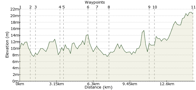
Ascent
20m (65ft)
Descent
9m (29ft)
Max. Elevation
30m (98ft)
Altitude Gain & Loss
29m (94ft)
Start
Teddington
End
Walton-on-Thames
Distance
15.00km
(9.32mi)
(9.32mi)
Duration
~4:15h
Difficulty
Moderate
Ordnance Survey Map
This walk takes you along part of the Thames Path as it leaves London and enters the suburban countryside. The route passes three locks, where you will probably see boats and barges heading through, and also passes the magnificent Tudor palace at Hampton Court. The walk can be done in either direction, and there is a good pub at either end (we plan these routes carefully, you know!)
Walk Functions
Share
Nearby Walks
Conflict between Ridiculous and Sublime
A leisurely, linear walk (city/town) starting in City of London, England, about 8.70km (5.41 mi) long, duration: ~2:15h.Historic Twickenham
A leisurely, circular walk (city/town) starting in City of London, England, about 5.30km (3.29 mi) long, duration: ~1:15h.Twickenham to Putney
A moderate, linear walk (riverside) starting in Surrey, England, about 12.20km (7.58 mi) long, duration: ~3:30h.Walk Map
- $walk->POI array(0)
Waypoints
OS Grid TQ160708
The walk starts in Teddington, which is easy to reach by train or bus. From the train station, head along Station Road and turn right into High Street, which leads to Teddington Lock.
OS Grid TQ167714
The first of the day's locks, and a well-known feature on the River Thames. The lock and weir are a hive of activity on summer weekends, with families picnicking, rowing and sailing courses on the river and joggers and cyclists enjoying some exercise. The Tide End is a good pub by the lock.
About 0.99 km (~0.62 miles) from 
OS Grid TQ172713
Cross the river at the lock and follow the Thames Path on the eastern bank of the river. This popular section of path takes you down to Kingston.
About 0.49 km (~0.3 miles) from 
OS Grid TQ177694
At Kingston, ignore the signposts and carry on alongside the river and under the railway bridge. At the road bridge, head up the steps and cross the river again.
About 2.03 km (~1.26 miles) from 
OS Grid TQ176692
Across the bridge, turn left into the park and take the Barge Walk around Hampton Court Park. This follows another very smart section of the River Thames - not even Henry VIII could afford to live here nowadays.
About 0.19 km (~0.12 miles) from 
OS Grid TQ156682
The path takes you past the magnificent Hampton Court Palace - former home of Henry VIII and well worth a visit if you are making a day of it:
hrp.org.uk/hamptoncourtpalace
About 2.18 km (~1.35 miles) from 
OS Grid TQ150685
After Hampton Court, cross the river again over the road bridge. Head left and cross the main road at the traffic lights - just past the little line of shops and restaurants, pick up the Thames Path again at Molesey Lock - number 2 on the walk.
About 0.63 km (~0.39 miles) from 
OS Grid TQ142692
The Thames Path is quieter along here, meaning you can enjoy a peaceful riverside walk and feel a long way from the busyness of London.
About 1.07 km (~0.66 miles) from 
OS Grid TQ109685
This is the third and final lock on this walk, and possibly one of the most attractive on the Thames.
About 3.37 km (~2.09 miles) from 
OS Grid TQ106681
The Weir Pub, just past the lock and unsurprisingly situated by the weir, is well worth a visit for a relaxing pint or spot of lunch.
About 0.47 km (~0.29 miles) from 
 Walton-on-Thames station
OS Grid TQ104648
It's a 20 minute walk from the pub to Walton-on-Thames station if you are travelling by train, or a bit shorter to pick up one of the buses in Walton town centre.
About 3.25 km (~2.02 miles) from 
