Malham Cove and Gordale Scar
A leisurely walk (moorland) in national park Yorkshire Dales in North Yorkshire, England, about 9.30km (5.78 mi) long with an estimated walking time of about 3:00h. It is unsuitable for families with children, prams & pushchairs, wheelchairs.
Elevation Profile
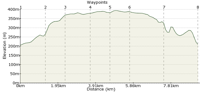
Ascent
184m (603ft)
Descent
179m (587ft)
Max. Elevation
400m (1312ft)
Altitude Gain & Loss
363m (1190ft)
Start & End
Malham
Distance
9.30km
(5.78mi)
(5.78mi)
Duration
~3:00h
Difficulty
Leisurely
Ordnance Survey Map
For many people, a walk to the geological wonders of Gordale Scar and Malham Cove is the highlight of the Yorkshire Dales. This walk visits both sites, and also explores the open moorland around Malham Tarn. Malham can be reached by Dalesbus from Skipton and Gargrave via the Dalesbus (www.dalesbus.org), with additional services at weekends and Bank Holidays in the summer. For a full day out, you can walk from Gargrave Station to Malham along the Pennine Way (about 9km each way).
Walk Functions
Share
Nearby Walks
Malham to Horton in Ribblesdale as a day walk
A moderate, linear walk (mountain (above 600m)) starting in North Yorkshire, England, about 16.50km (10.25 mi) long, duration: ~6:15h.Skipton Moor from Cracoe
A moderate, linear walk (low hills and fells (below 600m)) starting in North Yorkshire, England, about 15.00km (9.32 mi) long, duration: ~5:15h.Settle circular water walk
A moderate, circular walk (countryside) starting in North Yorkshire, England, about 9.80km (6.09 mi) long, duration: ~3:15h.Walk Map
- $walk->POI array(0)
Waypoints
OS Grid SD902629
From the bus stop in Malham, head along Cove Road and look for signs for the Pennine Way and Malham Cove.
OS Grid SD896641
One of the most spectacular and recognisable sights in England - an 80 foot high limestone cliff, curving around the hillside. Take the stone steps heading up the left-hand side of the cliff to fully appreciate its size. Much of the countryside around here is managed by the National Trust.
About 1.39 km (~0.86 miles) from 
OS Grid SD892649
At the top of Malham Cove, rejoin the Pennine Way across the limestone pavement of Ing Scar. Cross the road and continue on to Malham Tarn.
About 0.92 km (~0.57 miles) from 
OS Grid SD894661
Malham Tarn is England's highest freshwater lake, and a National Nature Reserve to boot. Several important bird species visit this wetland area, including redshanks, lapwings and curlews.
About 1.21 km (~0.75 miles) from 
OS Grid SD903663
Leave the Pennine Way and head between the two small patches of woodland. Just past the second wood, take the bridleway heading south.
About 0.92 km (~0.57 miles) from 
OS Grid SD905654
At the raised ground of Seaty Hill, the footpath heads across the limestone pavement and towards Gordale Scar.
About 0.92 km (~0.57 miles) from 
OS Grid SD916640
Gordale Scar is a spectacular limestone gorge, formed by the meltwater from glaciers. The cliffs reach up to 150m and the Gordale Beck cascades through the gorge. The path passes two waterfalls - take care scrambling down these sections, where the rocks can be loose and slippery.
About 1.72 km (~1.07 miles) from 
 Gordale Lane
OS Grid SD902628
From the gorge, follow the well-worn path back to Malham. The path passes Janet's Foss, a small waterfall on the Gordale Beck. Join Gordale Lane, which takes you into Malham for the bus home.
About 1.76 km (~1.09 miles) from 
