Ben Alder
A hard walk (mountain (above 600m)) in Highland, Scotland, about 44.70km (27.78 mi) long with an estimated walking time of about 15:30h (1 overnight stay). It is unsuitable for families with children, prams & pushchairs, wheelchairs.
Elevation Profile
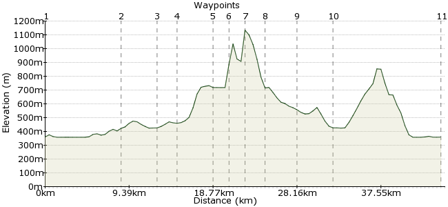
Ascent
776m (2545ft)
Descent
777m (2549ft)
Max. Elevation
1140m (3740ft)
Altitude Gain & Loss
1553m (5094ft)
Start & End
Dalwhinnie
Distance
44.70km
(27.78mi)
(27.78mi)
Duration
~15:30h
Difficulty
Hard
Ben Alder is a fine mountain, but not one to be taken lightly. The walk in alone takes the best part of a day, and it is a remote, wild place, especially when the weather turns. But it is a classic Scottish mountaineering trip on many people's list and, with proper planning, will be a memorable one too.
Starting at Dalwhinnie station, it's a long walk (or cycle by mountain bike) to the bothy at Culra, where most people stay overnight before the attempt on the summit.
Walk Functions
Share
Nearby Walks
The Munros of the Monadhliath mountains
A strenuous, circular walk (mountain (above 600m)) starting in Highland, Scotland, about 24.60km (15.29 mi) long, duration: ~9:15h.A Cairngorms Spectacular
A hard, linear walk (mountain (above 600m)) starting in Highland, Scotland, about 53.20km (33.06 mi) long, duration: ~19:00h.Creag Bheag - the little crag
A leisurely, circular walk (low hills and fells (below 600m)) starting in Highland, Scotland, about 4.20km (2.61 mi) long, duration: ~1:45h.Walk Map
- $walk->POI array(0)
Waypoints
OS Grid NN634847
Dalwhinnie Station is on the line heading up towards the Cairngorms. If you bring a bike, remember to check it is allowed on your train. Just near to the station is the long, long track that takes you to Ben Alder, along the edge of Loch Ericht.
OS Grid NN571787
The path splits near Ben Alder Lodge, as it leaves the forest. Take the right hand fork heading away from the loch towards Loch Pattack.
About 8.62 km (~5.36 miles) from 
OS Grid NN531783
Continue to Loch Pattack and take the path along the southern side. Take the track heading along the south side of Carn Dearg.
About 3.95 km (~2.45 miles) from 
OS Grid NN523762
Culra Bothy is a fine place to stay, a dash of comfort in the heart of the Highlands. It can get popular, though; if you head to Ben Alder on a weekend, you should carry a tent in case it's full. Check out www.mountainbothies.org.uk for more info on bothy stays.
About 2.30 km (~1.43 miles) from 
OS Grid NN513725
Day two is when the fun really starts. An early rise will give you the chance to take your time over the mountain, so up early, cup of tea and some porridge, then head into Bealach Beithe and the path heading around its namesake loch.
About 3.75 km (~2.33 miles) from 
OS Grid NN504705
Past the end of the loch, head into Bealach Breabag. There is a path heading up on to the ridge around Garbh Choire, which leads to the summit.
About 2.17 km (~1.35 miles) from 
OS Grid NN496718
The summit is 1148m, so a Munro and then some. It's also one of the most remote of all Scotland's summits, so take a while to enjoy the silence, the brisk mountain air, the staggering views in all directions. Then have some cake, as it's a long way home.
About 1.46 km (~0.91 miles) from 
OS Grid NN477729
To descend, leave the ridge line - that leads to the steep, rocky slopes around Coire na Lethchois. Instead, take a bearing to Meall an t-Slugain for an easier way down.
About 2.19 km (~1.36 miles) from 
OS Grid NN509749
The path in the valley takes you back to Culra Bothy. If time is of no issue, then why spend another night in this splendid landscape?
About 3.81 km (~2.37 miles) from 
OS Grid NN530778
Same way out as in - the long track home.
About 3.54 km (~2.2 miles) from 
 Dalwhinnie
OS Grid NN636843
Depending on train times and how you stagger your trip, you may need to spend the night in Dalwhinnie. The Inn is a popular place to stay www.theinndalwhinnie.com. It's also essential to have a local whisky - one of Scotland's finest!
About 12.47 km (~7.75 miles) from 
