St Catherine's Lighthouse, Niton
A leisurely walk (coast) in Isle of Wight, England, about 3.50km (2.17 mi) long with an estimated walking time of about 1:15h. It is suitable for families with children, prams & pushchairs, wheelchairs.
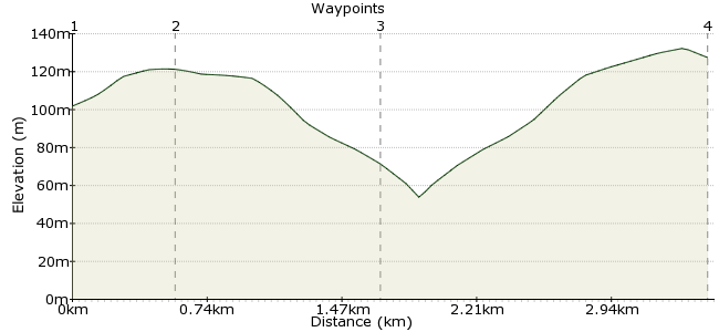
Elevation Profile
Ascent
89m (291ft)
Descent
107m (351ft)
Max. Elevation
140m (459ft)
Altitude Gain & Loss
196m (642ft)
Start & End
Niton High Street
Distance
3.50km
(2.17mi)
(2.17mi)
Duration
~1:15h
Difficulty
Leisurely
Ordnance Survey Map
A gentle walk, with a climb up a road on the way back, to the Isle of Wight's most southerly point. The lighthouse was built in 1838 and can be toured if you contact the lighthousekeeper in advance. There are plenty of opportunities for birdwatching on the undercliff. The terrain is mainly track and fields, and the coastal views are impressive. The No6 bus only runs in the daytime so start early and leave yourself time for a pint in the Buddle Inn.
Walk Functions
Share
Nearby Walks
Niton to St Lawrence to Whitwell
A leisurely, circular walk (coast) starting in Isle of Wight, England, about 8.00km (4.97 mi) long, duration: ~2:30h.Circular Tour Around the River Yar
A leisurely, circular walk (riverside) starting in Isle of Wight, England, about 5.80km (3.60 mi) long, duration: ~1:30h.Wilverley Common in the New Forest
A leisurely, linear walk (woodland) starting in Hampshire, England, about 8.90km (5.53 mi) long, duration: ~2:45h.Walk Map
- $walk->POI array(0)
Waypoints
OS Grid SZ506764
From Niton High Street, follow the road south towards the coast.
OS Grid SZ505760
Walk S through town then bear W down a B road. After 300m turn S down a marked footpath arriving at the Buddle Inn. Turn R out of the footpath then immediately L down a steep tarmacked footpath.
About 0.51 km (~0.32 miles) from 
OS Grid SZ496753
With the lighthouse visible, head W across the field then S towards the lighthouse going down a private road. Go through the gate into National Trust land and follow the coastal path to the trig point. At trig point turn E to Knowles Farm. Walk through the farmyard.
About 1.06 km (~0.66 miles) from 
 Niton village
OS Grid SZ506767
Follow the steep road back into Niton. At the junction, bear right and the road leads you back into the village, where you can catch the No6 bus to Ventnor or Newport.
About 1.76 km (~1.09 miles) from 
