Rhossili Bay and the Gower coastline
A moderate walk (coast) starting and finishing in West Glamorgan, Wales, about 17.20km (10.69 mi) long with an estimated walking time of about 5:30h. It is unsuitable for families with children, prams & pushchairs, wheelchairs.
Elevation Profile
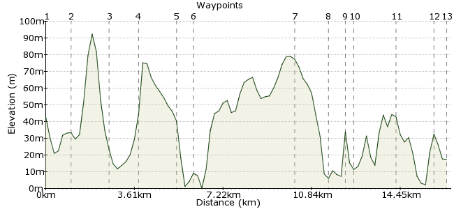
Ascent
200m (656ft)
Descent
225m (738ft)
Max. Elevation
100m (328ft)
Altitude Gain & Loss
425m (1394ft)
Start
Llangennith
End
Port Eynon
Distance
17.20km
(10.69mi)
(10.69mi)
Duration
~5:30h
Difficulty
Moderate
Ordnance Survey Map
The Gower Peninsula is a special place. The first part of the UK to get AONB status, it is a glorious mix of coast, farmland and heaths. This walk takes in many of the highlights - the National Trust's Rhossili Bay, Paviland Cave and the Worms Head, and the southern stretch of coast. The route from Llangennith to Port Eynon is possible in one long day, but better enjoyed with a stopover in Pitton Cross. Plus that gives you more time to enjoy this wonderful place!
Walk Functions
Share
Nearby Walks
Cefn Bryn on Gower
A leisurely, linear walk (low hills and fells (below 600m)) starting in West Glamorgan, Wales, about 8.00km (4.97 mi) long, duration: ~2:30h.Across Gower
A moderate, linear walk (low hills and fells (below 600m)) starting in West Glamorgan, Wales, about 18.20km (11.31 mi) long, duration: ~6:30h.Looping around Laugharne
A moderate, circular walk (coast) starting in Carmarthenshire, Wales, about 13.00km (8.08 mi) long, duration: ~4:00h.Walk Map
- $walk->POI array(0)
Waypoints
OS Grid SS426916
Take the bus to Llangennith. From the town centre, take the footpath heading for Hillend.
OS Grid SS417908
The walk starts in earnest at Hillend. There is a coastal campsite here which is a good option for the night before if you are planning a long day out. From Hillend, you have a choice - the clifftop path over Rhossili Down or the path along the foot of the cliff.
About 1.20 km (~0.75 miles) from 
OS Grid SS415892
Without wishing to lead the witness, I would opt for the beachside route. Plenty of clifftop walking on the second part of the route.
About 1.56 km (~0.97 miles) from 
OS Grid SS415880
The path takes you to Rhossili. From here, head past the village to the National Trust Office to check tide times - the Worms Head is only accessible around low tide. If you need to plan in advance, ring 01792 390707 and ask. There are also infrequent buses from Rhossili if you want a shorter walk.
About 1.17 km (~0.73 miles) from 
OS Grid SS401873
WARNING - do not mess about with the rocky crossing to the Worms Head. You need to enough time to get there and back as when the tide comes in, the current is extremely strong. You have been warned. If it is not possible to cross, there are still great views across from the mainland.
About 1.60 km (~0.99 miles) from 
OS Grid SS393874
Reaching the Worm, when the tide is out, involves an enjoyable scramble across the rocks. Check out the rockpools too - lots of wriggly creatures live here. Plenty of birdlife too. Once finished exploring, return back to Rhossili.
About 0.75 km (~0.47 miles) from 
OS Grid SS436876
if you are being sensible and taking two days to enjoy this wonderful scenery, then head to Pitton Cross Caravan and Camping site for your overnight stay: www.pittoncross.co.uk
There are also places to stay in Rhossili, but book ahead: www.enjoygower.com
About 4.20 km (~2.61 miles) from 
OS Grid SS428864
Start day two by heading to the coast south of Pitton Cross. Walk back along the road to Pitton, then take the footpath to the coast.
About 1.38 km (~0.86 miles) from 
OS Grid SS434861
The walk changes on the second day. The coast is a series of steep cliffs and hidden caves, many of which can be explored.
About 0.71 km (~0.44 miles) from 
OS Grid SS436858
One cave worth exploring is Paviland Cave, which is famous for the discovery of a skeleton here in 1830 - the first recorded human fossil. The skeleton was around 29,000 years old. It's possible - but tricky - to climb down to the cave. Look for the footpath coming in from the northeast.
About 0.27 km (~0.17 miles) from 
OS Grid SS451850
Continue along the path heading southeast towards Port Eynon. Great views, great place, great walking.
About 1.75 km (~1.09 miles) from 
OS Grid SS465846
Before reaching Port Eynon, head for the small spit of land south of the town to find Culver Hole. Again accessible only at low tide, this is a walled-up fissure with stairs behind the blocks. Some say it was used for smuggling, others think it was used to rear doves for meat and eggs.
About 1.44 km (~0.89 miles) from 
 Back to Port Eynon
OS Grid SS467852
Return from the hole to Port Eynon. It's a tourist hotspot, so plenty of places to stay and relax after a long walk. And you can rest those weary legs on the nearby beach the next day!
About 0.68 km (~0.42 miles) from 

2 comments... join the discussion!
Timwoods
Hi Kitty, Well the weather can be good or bad at any time of the year! My suggestion would be spring time, when the flowers will be out and the seabirds nesting. But it's a great walk at any time of year.
Kitty Hayes
Thanks for this site. When is best time of year to do this walk? Kitty