Princetown to Bellever
A moderate walk (moorland) in national park Dartmoor starting and finishing in Devon, England, about 10.90km (6.77 mi) long with an estimated walking time of about 3:30h. It is unsuitable for families with children, prams & pushchairs, wheelchairs.
Elevation Profile
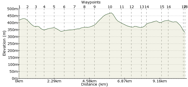
Ascent
196m (643ft)
Descent
283m (928ft)
Max. Elevation
480m (1574ft)
Altitude Gain & Loss
479m (1571ft)
Start
Princetown
End
Bellever
Distance
10.90km
(6.77mi)
(6.77mi)
Duration
~3:30h
Difficulty
Moderate
Ordnance Survey Map
A great hike in the heart of Dartmoor. Before starting the walk, visit the High Moorland Visitor Centre, which offers a
unique insight into Dartmoor’s fascinating history, its
landscape, wildlife and cultural heritage. The building
was the former Duchy Hotel and later the prison
officer’s mess. It was here that Sir Arthur Conan Doyle
stayed in 1901 when writing the Sherlock Holmes
novel “The Hound of the
Baskervillesâ€.
Walk Functions
Share
Nearby Walks
The Devonport Leat - a short walk from Princetown
A moderate, circular walk (moorland) starting in Devon, England, about 11.00km (6.84 mi) long, duration: ~3:30h.Wistman's Woods
A leisurely, circular walk (woodland) starting in Devon, England, about 7.30km (4.54 mi) long, duration: ~2:30h.The Lych Way
A moderate, linear walk (low hills and fells (below 600m)) starting in Devon, England, about 18.20km (11.31 mi) long, duration: ~5:45h.Walk Map
- $walk->POI array(0)
Waypoints
OS Grid SX592735
From the High Moorland Centre walk down the road past the
Railway Inn and the petrol station. Then, just after the entrance to
Oakery Crescent, turn right through the gate onto the bridleway.
OS Grid SX597735
Follow the track around and go through the two gates. At the point
where the track bears right you will get fantastic panoramic views of
the walk ahead with Bellever forest in the distance. On the other side
of the second gate you will cross the Devonport Leat.
About 0.60 km (~0.37 miles) from 
OS Grid SX602735
Continue along the path to the building ahead of you. Bachelors Hall, as it is known, was once a row of miners’ cottages for workers of the tin mine, which was discovered in 1790 when digging the Devonport Leat. The building is now run as a bunkhouse owned by Plymouth YMCA.
About 0.41 km (~0.25 miles) from 
OS Grid SX606738
From here follow the path left past the cowshed to the footbridge and over the stream and then along the Blackbrook to the next wooden bridge. Whilst walking along the river keep an eye out for a small brown bird with a white breast, aptly named a Dipper.
About 0.51 km (~0.32 miles) from 
OS Grid SX605744
Cross over the bridge and follow the path through the fields to the road. Turn right and walk along the road and over the cattle grid at the junction. Bear right and follow the old road over the West Dart River to the Two Bridges Hotel, were you can get some light
refreshments.
About 0.66 km (~0.41 miles) from 
OS Grid SX608749
The hotel was built in 1794 as a coaching inn at the opening of the trans-moor turnpike, the property was originally called 'The Saracen's Head'. It only gained its present name in the early 1900s with the modern road being completed in 1931.
About 0.54 km (~0.34 miles) from 
OS Grid SX609756
Cross over the B3212 to the car park and then through the gate;
follow this track to Crockern Farm. Walk around the stone wall of the
farm and then pick up the footpath again.
About 0.70 km (~0.43 miles) from 
OS Grid SX611761
The tor up on your right-hand side is Crockern Tor. It was here that the Stannary Court, the administrative body of the Dartmoor miners’ met between 1474 and 1703 .
About 0.57 km (~0.35 miles) from 
OS Grid SX612768
Follow the path up the West Dart Valley to Wistmans Wood. Please
respect this precious wood and only view it from the edges! It is famous for its gnarled Pedunculate Oak Trees and luxuriant mosses and lichens. 47 species of mosses & liverworts and 119 species of lichens have been recorded here.
About 0.67 km (~0.42 miles) from 
OS Grid SX615777
Walk about 50m along the edge of the wood and then turn 90° & climb up the side of the valley to the rock formation (Littaford Tor). When half way up, you can see the outline of the Devonport Leat running along the other side of the valley. The leat starts just up around the corner.
About 0.95 km (~0.59 miles) from 
OS Grid SX621774
Walk down the other side of the tor to the crumbling stone wall and climb over it via one of the stiles, now pick up the track that crosses the plateau to the tall chimney ahead of you.
About 0.66 km (~0.41 miles) from 
OS Grid SX627773
The ruin buildings or Powder Mills were founded in 1844 by George
Frean from Plymouth and
supplied gun powder for (open
cast) mines around Dartmoor. It closed down in 1897 when gun powder was substituted by dynamite and mining in the area
went downhill.
About 0.62 km (~0.39 miles) from 
OS Grid SX633774
Follow the track over the river and when halfway up the other side take the track to the right. Follow the small blue arrowed marker posts to the B3212.
About 0.57 km (~0.35 miles) from 
OS Grid SX635774
The path is a medieval trans—moor footpath known as the Lych Way ( Way of the Dead). Those living in this area that wished to bury their dead in a churchyard had to carry the corpses (“Lychesâ€) across the moor to Lydford Church.
About 0.21 km (~0.13 miles) from 
OS Grid SX645772
Cross over the road and follow the path straight ahead of you through the forest. At the end of this path you will see a finger post. Turn left here and walk along the path to the strip of open moorland. Continue along the path for a further 100m.
About 0.98 km (~0.61 miles) from 
OS Grid SX644777
Lakehead Hill has many Bronze Age (2000BC)antiquities. The Cist would once have been under a mound of earth, which was kept in place by the Cairn Circle surrounding it. The monument is aligned roughly east /west, in orientation to a large Cairn on Hamel Down to
the east.
About 0.48 km (~0.3 miles) from 
OS Grid SX651773
Climb over the other stile and walk down the rough path to the main gravel track. Turn right and then after 500m take the first left. Follow the path through the forest and down to the gate. Go through the gate and walk down the rough track through another gate and then along the road
About 0.81 km (~0.5 miles) from 
 Bellever
OS Grid SX653773
Finish at the Youth Hostel - £1 discount for those arriving by foot, bike or public transport!
About 0.20 km (~0.12 miles) from 
