Castle Cary to Bruton
A leisurely walk (riverside) starting and finishing in Somerset, England, about 7.60km (4.72 mi) long with an estimated walking time of about 2:15h. It is suitable for families with children, but unsuitable for prams & pushchairs, wheelchairs.
Elevation Profile
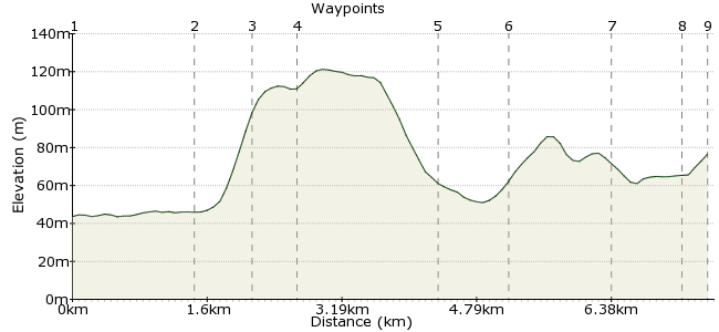
Ascent
90m (295ft)
Descent
57m (187ft)
Max. Elevation
130m (426ft)
Altitude Gain & Loss
147m (482ft)
Start
Castle Cary
End
Bruton, Somerset, England
Distance
7.60km
(4.72mi)
(4.72mi)
Duration
~2:15h
Difficulty
Leisurely
Ordnance Survey Map
This simple walk connects two stations on the Heart of Wessex line, Castle Cary and Bruton. The route weaves in and out of the Brue Valley, giving you a mix of riverside walking and views from the tops. Finishing in Bruton, you should leave time to wander around the town before catching the train home, either to explore the hidden corners of this market town, or to enjoy a pint in one of its cosy pubs.
Walk Functions
Share
Nearby Walks
A South Somerset stroll
A leisurely, circular walk (countryside) starting in Somerset, England, about 9.40km (5.84 mi) long, duration: ~3:15h.Glastonbury Tor
A leisurely, circular walk (countryside) starting in Somerset, England, about 5.20km (3.23 mi) long, duration: ~1:45h.Ebbor Gorge
A leisurely, circular walk (countryside) starting in Somerset, England, about 6.20km (3.85 mi) long, duration: ~2:15h.Walk Map
- $walk->POI array(0)
Waypoints
OS Grid ST634335
Take the train to Castle Cary station. Best avoid the last weekend in June, or you will be lost in a sea of hippies and over-excited teenagers on their way to Glastonbury Festival.
OS Grid ST648339
Exit the station via the gate next to the footbridge. A bridleway leads through the flooplain of the River Brue. Nice gentle start to the hike.
About 1.46 km (~0.91 miles) from 
OS Grid ST646333
You can continue along the bridleway, but you will get to Bruton a bit too quickly. Instead, take the footpath across the railway, which leads uphill to Andsford Park Farm.
About 0.69 km (~0.43 miles) from 
OS Grid ST644328
Continue along Park Lane to join the Macmillan Way.
About 0.44 km (~0.27 miles) from 
OS Grid ST660335
The path, which doubles as the Leland Trail and Macmillan Way, leads past some orchards as it winds back into the valley.
About 1.70 km (~1.06 miles) from 
OS Grid ST667339
At Cole, joins the road that leads you back across the railway.
About 0.79 km (~0.49 miles) from 
OS Grid ST677345
Follow the bridleway up a short steep path and around the back of Gants Mill and then on through Mill on the Brue activity centre - making sure you keep to the waymarkings and being wary of children flying through the air above your head!
About 1.19 km (~0.74 miles) from 
OS Grid ST685348
Enjoy the delights of this charming little town before picking up the train home. Worth visiting the Bartons, the small holding yards where livestock were once kept on market days. They are just behind the High Street.
About 0.84 km (~0.52 miles) from 
 Bruton Station
OS Grid ST688347
To the station for the train home.
About 0.26 km (~0.16 miles) from 

9 comments... join the discussion!
Chris
Nice walk, lots of variety. Walked through barley fields, under tree cover, through apple orchards and across train lines. Walked through fields with cows, horses and deer, generally very pleasant. The directions aren't fantastic and we got lost a few times so took about 2hrs 30mins. Last 3rd of the walk was very overgrown with nettles. Without google maps it would have been very difficult
Gary
The crossing is still there but does require close investigation. As a rough gauge, it is in a position on a straight line from the right angled field boundary to the north
emma
We missed the pedestrian crossing at point 2, completley could not see this. so ended up walking some of the walk on the road. was a nice walk other than this.
Douglas
To clarify point 2. Exit the station from the gate at the bottom of the footbridge (station side). Turn right directly after gate, walk along lane into field, cross field keeping to left of row of mature trees, second field Bridleway is more obvious, stay on Bridleway until you see railway pedestrian crossing, continue as point 3 instructions
Timwoods
OK,the footpath/bridleway is next to the footbridge over the railway. It's best not to detour via the road as it's very busy and on a bend. The bridleway then follows the railway for a distance.
Timwoods
Hi Martin, very sorry to hear that. When I did the walk, it was through a gate at the far end of the platform as I recall. But it's possible they have closed this... I will try and find out. Looking at the satellite image on Google maps, it looks like you can turn right along the A371 and then right again into Station Road and that will take you to the start point.
martin thomas
Oh dear! Spent ages trying to find the Bridleway to start this walk. Workers and local people were unable to help. Eventually had to give up. Parking and train fare wasted and more than that, disappointment. Clearer instruction needed please to help people with little local knowledge.
GaryShipp
Thanks Elaine for your comment. We have amended point 7 as you suggest. This should now be clearer for folk following the route.
Elaine
Please note that point 7 should be amended to read 'above Gants Mill' or 'behind Gants Mill' as that is where the bridle path actually is - as you can see by the contour lines on the map!