Circular walk using some of Sankey Valley Park
A moderate walk (canal) in Greater Manchester, England, about 13.80km (8.57 mi) long with an estimated walking time of about 4:00h. It is suitable for families with children, but unsuitable for prams & pushchairs, wheelchairs.
Elevation Profile
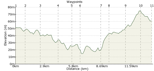
Ascent
62m (203ft)
Descent
51m (167ft)
Max. Elevation
80m (262ft)
Altitude Gain & Loss
113m (370ft)
Start & End
Ashton-in-Makerfiled
Distance
13.80km
(8.57mi)
(8.57mi)
Duration
~4:00h
Difficulty
Moderate
Ordnance Survey Maps
 7Created by ashtonkroz on 16 Sep 2012
A circular walk from Ashton-in-Makerfield along lanes, footpaths, canal towpath and through part of the Sankey Valley park.
Walk Functions
Share
Nearby Walks
Field and canal around Pennington Flash
A moderate, circular walk (canal) starting in Greater Manchester, England, about 14.10km (8.76 mi) long, duration: ~4:00h.Carr Mill Dam from Ashton-in-Makerfield
A moderate, circular walk (countryside) starting in Greater Manchester, England, about 15.50km (9.63 mi) long, duration: ~4:30h.Billinge Hill from Bryn Station
A moderate, circular walk (countryside) starting in Greater Manchester, England, about 12.40km (7.71 mi) long, duration: ~3:45h.Walk Map
- $walk->POI array(0)
Waypoints
OS Grid SJ580991
Walk up Gerrard street to Butchers lane, turn left and the left again onto Heath road. Walk down this road about 300m to Ashton Heath. Take the path down the middle of the Heath to the end then turn left and then right through a gate towards Haydock Racecourse.
OS Grid SJ587984
Walk towards the racecourse gate and then take the path on the left alongside the racecourse. At the end of this path turn right and walk along a secluded lane for about half a mile until you come to a gate across the road. Turn right and then cross the busy A580 with care.
About 0.95 km (~0.59 miles) from 
OS Grid SJ597972
Cross the A580 and walk for about half a mile until you pass under a motorway bridge. Then take a scramble up to path on the left up to the side of the motorway. Walk for about 250m alonside the motorway and then take a path on the right which leads to Newton-le-Willows High Street.
About 1.53 km (~0.95 miles) from 
OS Grid SJ592956
Turn left along the High street, cross over as soon as you can safely then continue for about 250m until you pass under a railway bridge. Take a public footpath on the right and then take the left fork. Continue on this path for about half a mile until you pass through a gap onto a path a right angles to your path. Turn right here and after about 100m take a path on the right and then turn left onto a path to Vulcan Park way.
About 1.62 km (~1.01 miles) from 
OS Grid SJ588943
Carry on along the Vulcan Park way for about half a mile bearing left then right until you reach Wargrave road. Cross Wargrave Road and the railway bridge and walk down Bradleigh road for about 200m then turn left along Tyrer with an open grassy area to your right. When you leave the grassy area take the 2nd junction on your right which leads to a path down to the Sankey Canal
About 1.37 km (~0.85 miles) from 
OS Grid SJ582938
Cross to the otherside of the canal and turn right along the Canal towpath. Keep on this path for about a mile and a half. Some of the canal has been filled in. The path passes under some spectacular railway arches. About 300m past the railway arches leave the path and turn right onto Earle street
About 0.87 km (~0.54 miles) from 
OS Grid SJ565948
walk up Earle street for about 50m and then turn left into a park. Immediately turn right and follow the path up the middle of the park. At the end of the path, cross Sturgess street and continue on a path which leads to Crow Lane west (A572). Turn left and walk for about 100m then cross the road to Lyme street by a convenience store.
About 1.97 km (~1.22 miles) from 
OS Grid SJ566957
Walk down Lyme Street past a school and onto a foootpath straight ahead. Keep on this path for about half a mile until it comes onto Grange valley road. Walk up this road and turn right at the top. Cross the road and turn left towards a row of shops (Icaland and Aldi) pass to the left of the shops and onto a path on a grassy area behind the shops. Turn right and walk for 50m to a path on the left leading up to a wooded area.
About 0.82 km (~0.51 miles) from 
OS Grid SJ557969
walk up through the trees to the top of the rise then take the path which forks right. Walk down this path until it meets another path where you must turn left. keep on this path until you reach the A580 dual carraige way. Turn left and walk to the traffic lights where you can cross over the dual carraigeway to Haydock Lane. Walk along Haydock lane to the end (about half a mile).Turn left and then cross over to the other side of the road for the boundary path.
About 1.56 km (~0.97 miles) from 
OS Grid SJ561983
About 50m from haydock lane take the path on the right down past the side of Ashton Golf course. Keep on this path for about half a mile until you reach a footbridge over the M6 mtorway
About 1.44 km (~0.89 miles) from 
 Motor Way footbridge
OS Grid SJ573984
cross the footbridge and follow the path round the side of Birchall High School. When you reach the A49 turn left and walk for about half a mile to some traffic lights by the Kings Arms pub. Turn right here and make your way down Gerrard street to the bus stop for your journey home.
About 1.17 km (~0.73 miles) from 
