Point of Ayr RSPB reserve
A leisurely walk (coast) in Flintshire, Wales, about 4.40km (2.73 mi) long with an estimated walking time of about 1:15h. It is suitable for families with children, but unsuitable for prams & pushchairs, wheelchairs.
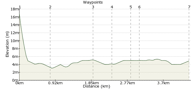
Elevation Profile
Ascent
6m (19ft)
Descent
19m (62ft)
Max. Elevation
20m (65ft)
Altitude Gain & Loss
25m (81ft)
Start & End
Talacre
Distance
4.40km
(2.73mi)
(2.73mi)
Duration
~1:15h
Difficulty
Leisurely
Ordnance Survey Map
 1Created by driver 16 on 03 Mar 2013
Situated at Talacre, Flintshire, North Wales on the Wales Coast Path, this SSSI reserve has a lighthouse, gas terminal, old colliery, and views to the Wirral, Mostyn and Connah's Quay Docks. The route is pram and wheelchair accessible on the Wales Coast Path, but, obviously NOT on dunes or beach.Â
This website has more about the reserve: http://www.rspb.org.uk/reserves/guide/d/dee-pointofayr/index.aspx
Walk Functions
Share
Nearby Walks
Prestatyn Hillside
A leisurely, circular walk (low hills and fells (below 600m)) starting in Denbighshire, Wales, about 8.10km (5.03 mi) long, duration: ~2:45h.Holywell and Greenfield Valley Heritage Park
A leisurely, circular walk (woodland) starting in Flintshire, Wales, about 2.90km (1.80 mi) long, duration: ~0:45h.Holywell 2
A leisurely, circular walk (countryside) starting in Flintshire, Wales, about 8.40km (5.22 mi) long, duration: ~2:45h.Walk Map
- $walk->POI array(0)
Waypoints
OS Grid SJ112834
The start of the walk is situated between two of my other walks, Prestatyn Hillside and Holywell Greenfield Park Heritage Trail. On the way to the RSPB reserve you could visit the lighthouse dating from 1776, abandoned in 1883. The sand dunes are a Site of Special Scientific Interest (SSSI). You will pass the gas terminal and the site of the old colliery, with views to both Mostyn Dock where wind turbines are assembled for the new Irish Sea wind farm, and Connah's Quay dock where the wings for the airbus family, having been brought from the factory at Broughton on barges down the River Dee, are loaded onto ships for delivery to France.
OS Grid SJ117840
The hide is usually locked, but if you wish to look out over fields to Tyn-y-Morfa, a key is available from the offices of Granary Court, situated at Dangerpoint, just over the road on the right.
About 0.74 km (~0.46 miles) from 
OS Grid SJ124848
Behind the Inn is the Wales Coast Path. If you wish to visit the lighthouse, turn left into the dunes, an area of SSSI, home to natterjack toads, rare flowers and of course birds. The lighthouse, built in 1776 and abandoned in 1883, has seen ghostly sightings and in 2010 a climber painted it by abseiling from the tower for a TV advert.
About 1.09 km (~0.68 miles) from 
OS Grid SJ123843
Gas from BHP's rig in Liverpool Bay, enough to provide electricity for half of wales, is piped ashore to this terminal, then piped to a purpose-built power station at Connah's Quay to be burnt.
About 0.50 km (~0.31 miles) from 
OS Grid SJ127841
A shaft was sunk in 1890, and by 1896 the colliery employed 356 men. By 1918, it had 481 men and its own wharf for shipments. After nationalisation in 1947, a third shaft was sunk. By 1953 it was employing 738 men and producing 213,000 tons of coal annually. It closed in 1996.
About 0.44 km (~0.27 miles) from 
OS Grid SJ125842
Built with donations from BHP Billiton and Flintshire County Council, this hide is not only for bird watching, but provides views over to the Wirral and Mostyn Docks, where the wind turbines for new Irish Sea wind farm are being assembled. You can also see Connah's Quay, from where the wings for airbuses are exported to France. It's worth spending time here, as we found out, you never know what surprises are going to turn up! When finished, if you don't want to explore more of the Wales Coast Path, retrace your steps to the start of the walk.
About 0.19 km (~0.12 miles) from 
 End of the walk
OS Grid SJ115835
Retrace your steps back to the start of the walk. I hope you enjoyed it and learn about the history of this part of North Wales.
About 1.21 km (~0.75 miles) from 
