Iver To Staines
A moderate walk (riverside) starting and finishing in Buckinghamshire, England, about 13.90km (8.64 mi) long with an estimated walking time of about 4:00h. It is suitable for families with children, but unsuitable for prams & pushchairs, wheelchairs.
Elevation Profile
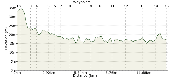
Ascent
6m (19ft)
Descent
22m (72ft)
Max. Elevation
40m (131ft)
Altitude Gain & Loss
28m (91ft)
Start
Iver Station
End
Staines, Staines, Middlesex, England
Distance
13.90km
(8.64mi)
(8.64mi)
Duration
~4:00h
Difficulty
Moderate
Ordnance Survey Map
A flat walk over many paths not frequently used. The first part of the walk has some very interesting houses. Definitely a walk for plane spotters.
Walk Functions
Share
Nearby Walks
Langley to Farnham Common
A leisurely, linear walk (city/town) starting in Berkshire, England, about 9.40km (5.84 mi) long, duration: ~2:45h.Langley to Hedgerley
A moderate, linear walk (countryside) starting in Berkshire, England, about 11.50km (7.15 mi) long, duration: ~3:30h.Harlington Corner to Richmond
A moderate, linear walk (city/town) starting in Greater London, England, about 13.00km (8.08 mi) long, duration: ~3:45h.Walk Map
- $walk->POI array(0)
Waypoints
OS Grid TQ037799
Exit station to the south and continue across crossroads.
OS Grid TQ037796
At fork continue to right along Wellesley Avenue. On reaching main road turn right and then shortly left into Old Slade Lane. Note the amazing diversity of house styles along this road !
About 0.26 km (~0.16 miles) from 
OS Grid TQ036787
Continue straight ahead along Old Slade Lane until road diminishes into a wide track. Continue along this track as it crosses the M4 Motorway. As you descend bridge track bends to right.
About 0.94 km (~0.58 miles) from 
OS Grid TQ037781
At the entrance to the sewerage farm turn left onto track alongside gravel pit. Continue until you reach the Colne Brook where you bear right alongside it. You leave the brook for a while but re-join it shortly. Eventually path exits onto the Colnbrook By-Pass.
About 0.57 km (~0.35 miles) from 
OS Grid TQ030773
Cross the A4 carefully and continue in the same direction to the right of a transport cafe. After a short while you enter Mill Street in Colnbrook village. Continue ahead until you reach the High Strett.
About 1.06 km (~0.66 miles) from 
OS Grid TQ027771
On reaching the High Street turn right and continue through the village. At the road junction at the end of the High Street turn sharp left into Drift Way.
About 0.44 km (~0.27 miles) from 
OS Grid TQ022769
At the end of Drift Way continue straight ahead along a path alongside the right hand side of a field. This path passes directly under the Heathrow approach and if they are landing from the west be prepared for some spectacular low flypasts !
About 0.54 km (~0.34 miles) from 
OS Grid TQ018761
When the path turns into a rather muddy lane continue ahead to the main road. Here turn right past the 5 Bells, a possible refreshment stop, but not the scheduled lunch stop. At the village green turn left into Park Lane and when this road fizzles out continue ahead on a path that passes between many small reservoirs.
About 0.87 km (~0.54 miles) from 
OS Grid TQ007745
When this path turns into a small lane continue along it to the main road. Turn right into the village and take lunch at the excellent Perseverance pub. Good beer, good food and one of the best pub signs around.
About 1.87 km (~1.16 miles) from 
OS Grid TQ004739
Upon leaving the pub, turn left and re-trace your steps. Continue past the point where you joined the main road and carry on to Wraysbury station.
About 0.71 km (~0.44 miles) from 
OS Grid TQ014742
Immediately past the station turn right onto a narrow path which runs right alongside the railway. After about 600 metres turn right onto a path which first crosses the railway and then winds its way through a damp area of land. On reaching the sailing club continue ahead to the main road.
About 1.01 km (~0.63 miles) from 
OS Grid TQ010730
Turn left along Staines Road until you have passed under the M25. Then immediately turn right, where the path takes you up over the Thames alongside both the A30 and M25. This is a noisy bit. As soon as you have crossed the river take a scrambly path to your left down the slope onto the Thames path.
About 1.29 km (~0.8 miles) from 
OS Grid TQ020719
Continue right along the Thames path until you come to Staines Bridge. Cross the bridge into the town.
About 1.49 km (~0.93 miles) from 
OS Grid TQ032716
Once over the bridge turn right and continue ahead, even where the road turns into the pedestrian precinct. When you reach the end of the precinct, cross the road, bear right and follow the signs to Staines station.
About 1.25 km (~0.78 miles) from 
 Staines Station
OS Grid TQ041714
Walk ends here. Trains from here go to London, Reading, Weybridge and Windsor.
About 0.94 km (~0.58 miles) from 

1 comment... join the discussion!
David Harrison
This looks like an interesting walk although I would not agree with the description that the walk starts and finishes in Buckinghamshire. Staines (Or Staines-upon-Thames) is currently in Surrey but was previously in Middlesex.