Twickenham to Putney
A moderate walk (riverside) starting and finishing in Surrey, England, about 12.20km (7.58 mi) long with an estimated walking time of about 3:30h. It is suitable for prams & pushchairs, wheelchairs, but unsuitable for families with children.
Elevation Profile
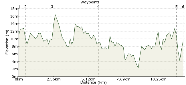
Ascent
4m (13ft)
Descent
5m (16ft)
Max. Elevation
20m (65ft)
Altitude Gain & Loss
9m (29ft)
Start
Twickenham
End
Putney Station
Distance
12.20km
(7.58mi)
(7.58mi)
Duration
~3:30h
Difficulty
Moderate
Ordnance Survey Map
This riverside walk takes in some of the nicest stretches of the Thames Path. There are several points of interest along the way, and good pubs as well for refreshments.
Walk Functions
Share
Nearby Walks
The River Crane walk
A leisurely, linear walk (riverside) starting in Surrey, England, about 4.40km (2.73 mi) long, duration: ~1:15h.Marble Hill to Bushy Park
A moderate, linear walk (riverside) starting in City of London, England, about 12.20km (7.58 mi) long, duration: ~3:30h.Richmond & St. Margarets Loop
A leisurely, circular walk (riverside) starting in City of London, England, about 6.70km (4.16 mi) long, duration: ~1:30h.Walk Map
- $walk->POI array(0)
Waypoints
OS Grid TQ159735
Start of the walk
OS Grid TQ163732
Turn left out of the station and head towards Twickenham town centre. You should soon see the river Thames in front of you.
About 0.53 km (~0.33 miles) from 
OS Grid TQ177744
Follow the path along the Thames, which passes a couple of nice pubs and two large parks. When you get to Richmond Bridge (the first one you meet) go up the steps and cross to the other side of the river.
About 1.86 km (~1.16 miles) from 
OS Grid TQ186776
Follow the Thames on the same side of the river. You will soon come up alongside Kew Gardens.
About 3.33 km (~2.07 miles) from 
OS Grid TQ241755
The Thames path follows both sides of the river, so you can walk along either side. There are several attractive bridges along here, and you will also pass Fulham FC, Putney rowing club, and some very nice houses!
About 5.78 km (~3.59 miles) from 
 Finish
OS Grid TQ245758
From Putney Bridge, you can get home from Putney Bridge Tube Station(north side). Alternatively, head up Putney High Street for East Putney Tube Station or Putney railway station.
About 0.46 km (~0.29 miles) from 

1 comment... join the discussion!
Heinrich
The Thames Path is a great way to see London without going near roads. Plus, once you are on the path you can't get lost and you can add extra or leave the walk early as you pass near lots of train stations along the way.