Dream St.Helens
A leisurely walk (woodland) in Merseyside, England, about 2.10km (1.30 mi) long with an estimated walking time of about 0:30h. It is suitable for prams & pushchairs, wheelchairs, but unsuitable for families with children.
Elevation Profile
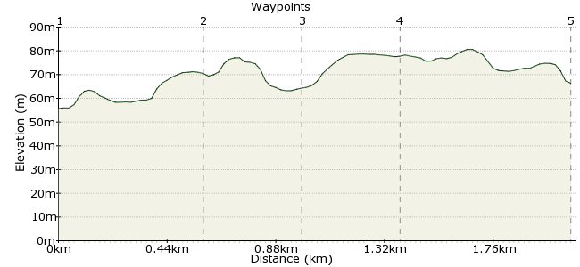
Ascent
19m (62ft)
Descent
20m (65ft)
Max. Elevation
90m (295ft)
Altitude Gain & Loss
39m (127ft)
Start & End
Jubits Lane, Sutton Manor
Distance
2.10km
(1.3mi)
(1.3mi)
Duration
~0:30h
Difficulty
Leisurely
Ordnance Survey Map
 Created by floprob on 21 Mar 2016
Dream is located on the prominent summit of the former Sutton Manor Colliery in St.Helens, Merseyside.
There are several walks around the site, which offer good views across the Cheshire and Lancashire plains, out to the mountains of Snowdonia, the Pennines and the Peak District. For more information, visit:
www.dreamsthelens.com/visiting-dream/
Walk Functions
Share
Nearby Walks
Carr Mill Dam from Ashton-in-Makerfield
A moderate, circular walk (countryside) starting in Greater Manchester, England, about 15.50km (9.63 mi) long, duration: ~4:30h.Field and canal around Pennington Flash
A moderate, circular walk (canal) starting in Greater Manchester, England, about 14.10km (8.76 mi) long, duration: ~4:00h.Circular walk using some of Sankey Valley Park
A moderate, circular walk (canal) starting in Greater Manchester, England, about 13.80km (8.57 mi) long, duration: ~4:00h.Walk Map
- $walk->POI array(0)
Waypoints
OS Grid SJ516906
There are several local buses to Dream. More info here: www.dreamsthelens.com/visiting-dream/visiting-by-public-transport/
OS Grid SJ521907
Dream is 20 metres high, however its foundation piles go almost twice that height down underground...
On average, 100,000 vehicles pass Dream daily, equating to more than 35 million a year
About 0.51 km (~0.32 miles) from 
OS Grid SJ520904
This is the circular round the bottom
About 0.31 km (~0.19 miles) from 
OS Grid SJ523906
Round the top were the statue is
About 0.32 km (~0.2 miles) from 
 Back to the bus stop
OS Grid SJ516907
After you have explored the site, return to the bus stop for the ride home.
About 0.65 km (~0.4 miles) from 
