Dunkery Beacon
A moderate walk (moorland) in national park Exmoor in Somerset, England, about 14.60km (9.07 mi) long with an estimated walking time of about 5:30h. It is unsuitable for families with children, prams & pushchairs, wheelchairs.
Elevation Profile
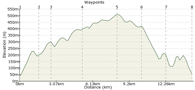
Ascent
469m (1538ft)
Descent
452m (1482ft)
Max. Elevation
510m (1673ft)
Altitude Gain & Loss
921m (3020ft)
Start & End
Porlock
Distance
14.60km
(9.07mi)
(9.07mi)
Duration
~5:30h
Difficulty
Moderate
Ordnance Survey Map
This walk combines three of Exmoor's finest features - heather moorland, lush deciduous woodland and the chance to see plenty of wildlife. Starting from Porlock, the walk heads through Hawkcombe Woods, onto the moorland of Dunkery Hill and back through Horner Wood, before returning to Porlock in time for a cream tea. Perfect.
Walk Functions
Share
Nearby Walks
Cosgate Hill to Countisbury
A moderate, circular walk (coast) starting in Devon, England, about 12.40km (7.71 mi) long, duration: ~4:30h.Grabbist Hill and Knowle Hill
A leisurely, circular walk (countryside) starting in Somerset, England, about 6.70km (4.16 mi) long, duration: ~2:30h.The moors of Exmoor
A strenuous, circular walk (moorland) starting in Devon, England, about 20.00km (12.43 mi) long, duration: ~7:15h.Walk Map
- $walk->POI array(0)
Waypoints
OS Grid SS886467
Several bus services in Somerset and Exmoor call at Porlock. From the church in the town centre, take the road heading south. The bridleway to Hawkcombe Woods is just 200m from the church.
OS Grid SS873457
Follow the path into the woods. Cross the river so you walk along the south side and follow it through the woods. Keep your eyes peeled for birds in the trees and along the riverbanks in this beautiful nature reserve.
About 1.64 km (~1.02 miles) from 
OS Grid SS866451
The footpath leaves the wood and heads towards Lucott Farm. Pick up the bridleway heading up Tarr Ball Hill.
About 0.92 km (~0.57 miles) from 
OS Grid SS865424
The path heads out onto the moor and meets the moorland road. It's open access land so you can wander as you please! Head for the high ground, where you will pick up the path to Dunkery Beacon.
About 2.70 km (~1.68 miles) from 
OS Grid SS892415
The highest point in Somerset! If you are lucky, you may spot red deer here, or even the famous Exmoor ponies. Follow the path on to Dunkery Hill.
About 2.84 km (~1.76 miles) from 
OS Grid SS907427
Veer north off the hill and down the slope towards the Dunster Path and Horner Wood.
About 1.92 km (~1.19 miles) from 
OS Grid SS898445
More spectacular woodland walking on the way home, through Horner Wood. Follow the Windsor Walk to the small village of Horner. Stop to admire the water mill and packhorse bridge.
About 2.01 km (~1.25 miles) from 
 Back to Porlock
OS Grid SS888464
Now named the Coleridge Way, the path takes you around the foot of Ley Hill and back into Porlock. Time to hunt out one of those world famous cream tea!
About 2.15 km (~1.34 miles) from 

5 comments... join the discussion!
lewis
Thanks for the route. The GPX was pretty off. Was on route for about 2 minutes on the whole walk. Followed the descriptions and used view ranger too. Great walk though.
Will H
Great walk, leaving from porlock a treat, top of dunkery beacon is gorgeous, thank you for well thought out route
patrikG
Well, this is probably the place I saw from the other side of Bristol channel when I was walking along the beautiful coast of Wales.
GaryShipp
Well this is where I nearly got my first taste of hyperthermia. In May! Never underestimate how the hills here can catch the weather.
Timwoods
This was the first place I ever got lost! Thick cloud, inexperienced Duke of Edinburgh (bronze) group, and, er...holding the compass upside down and heading west instead of east! Lesson learned.