Across the Yorkshire Dales
A hard walk (low hills and fells (below 600m)) in national park Yorkshire Dales starting and finishing in North Yorkshire, England, about 63.10km (39.21 mi) long with an estimated walking time of about 22:30h (2 overnight stays). It is unsuitable for families with children, prams & pushchairs, wheelchairs.
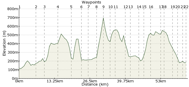
Elevation Profile
Ascent
1298m (4258ft)
Descent
1235m (4051ft)
Max. Elevation
700m (2296ft)
Altitude Gain & Loss
2533m (8309ft)
Start
Gargrave
End
Grinton
Distance
63.10km
(39.21mi)
(39.21mi)
Duration
~22:30h
Difficulty
Hard
Think you know the Dales? Even for regular visitors, a three-day walk across the National Park, from the southern boundary to the northern edge, is bound to throw up a few new highlights and hidden gems. This walk takes you through five different dales and is best enjoyed over three to four days. There is accomodation in all towns and villages, so plan your overnight breaks according to your preferred pace. So book a ticket, dust off a James Herriot book for the evenings, and enjoy!
Walk Functions
Share
Nearby Walks
Gargrave to Settle
A moderate, linear walk (countryside) starting in North Yorkshire, England, about 17.30km (10.75 mi) long, duration: ~5:45h.Embsay Crag and Embsay Moor
A moderate, circular walk (low hills and fells (below 600m)) starting in North Yorkshire, England, about 10.80km (6.71 mi) long, duration: ~3:45h.Skipton Moor from Cracoe
A moderate, linear walk (low hills and fells (below 600m)) starting in North Yorkshire, England, about 15.00km (9.32 mi) long, duration: ~5:15h.Walk Map
- $walk->POI array(0)
Waypoints
OS Grid SD933536
The journey starts at Gargrave Station, on the Settle-Carlisle line. The station is just south of the village. In the village itself, pick up the Pennine Way heading north.
OS Grid SD904593
Navigation is easy - the Pennine Way is a much-trodden and well signposted route - across some pleasant farming countryside. The view ahead is a tantalising glimpse of what is to come. Continue past the village of Airton and keep heading north.
About 6.39 km (~3.97 miles) from 
OS Grid SD901628
The PW continues into Malham, which has a Youth Hostel. The scenery steps up a notch here, and the first decision awaits you too - straight on to marvel at the unique limestone cliff of Malham Cove, or northeast to the scramble up Gordale Scar.
About 3.51 km (~2.18 miles) from 
OS Grid SD906677
Whichever route you choose - and both are superb - aim for Middle House Farm, an outpost on Malham Moor. From here, take the bridleway towards Cowside Beck and Arncliffe.
About 4.92 km (~3.06 miles) from 
OS Grid SD932718
Arncliffe in Littondale - the first of the five - sits at the end of Cowside Beck. Also time to switch maps to OL30 - Yorkshire Dales northern and central areas. From Arncliffe, head over Middlemoor Pasture.
About 4.85 km (~3.01 miles) from 
OS Grid SD968724
If you are going for a big first day, there is also a Youth Hostel in Kettlewell. With all Dales accommodation, ther golden rule is - book well ahead! Those turning up hopefully will often be left looking for a dry barn somewhere...
About 3.64 km (~2.26 miles) from 
OS Grid SD950745
This section along the Dales Way through Wharfedale is one of the highlights - a beautiful river valley teeming with birdlife. The string of woodland along the western side adds a warm character to the dale, and the riverside path is easy going.
About 2.76 km (~1.71 miles) from 
OS Grid SD942774
Cross the River Wharfe at Buckden, towards the northern end of Wharfedale. Look for the Buckden Rake bridleway, on the western flank of Buckden Pike.
About 3.01 km (~1.87 miles) from 
OS Grid SD961788
Still feeling fresh? Take a detour up to Buckden Pike for fantastic views along Wharfedale and into Langstrothdale.
About 2.35 km (~1.46 miles) from 
OS Grid SD944805
Descend to Cray Gill, a steep valley at the northern tip of Wharfedale. Cross the Causeway road and head on to the Gilbert Lane track.
About 2.40 km (~1.49 miles) from 
OS Grid SD934824
A change of scenery again - Stake Moss is a wild place compared to Wharfedale. The ground is boggy and only the hardiest cattle and sheep hang about up here. The path is easy to follow, though. At the first footpath junction, take the path along Silky Gill into Raydale.
About 2.14 km (~1.33 miles) from 
OS Grid SD918858
Raydale is a hidden gem - little visited, but surely one of the most captivating of the dales (and number three on this route, if you're ticking them off).
About 3.75 km (~2.33 miles) from 
OS Grid SD921875
Paths weave their way around Semer Water and through the hamlets nestled in Raydale's quiet corners. Keep on a northern bearing - you're aiming for Bainbridge.
About 1.75 km (~1.09 miles) from 
OS Grid SD934899
Wensleydale is quite a contrast to Raydale - it's the most popular dale with visitors, and there's a steady stream of tourists. No youth hostel here, but plenty of B & Bs and campsites in Bainbridge, or a couple of miles west in Hawes.
About 2.80 km (~1.74 miles) from 
OS Grid SD949912
Cross the River Ure over the Yore Bridge - lovely views from here - and head into Askrigg.
About 1.87 km (~1.16 miles) from 
OS Grid SD964937
It's a steep climb from Askrigg on to the open access land around Woodhall Greets. The nature of the walk changes again here - open grouse moor, where navigation is a bit trickier but the sense of space is awesome. It's a day for exploring the northern side of the Yorkshire Dales.
About 2.91 km (~1.81 miles) from 
OS Grid SD993958
Severak paths and bridleways run parallel to Swaledale, helping to keep you going in the right direction. There are lots of old mine shafts around here, and grouse butts all over. Interesting features and a nod to the moor's working side.
About 3.57 km (~2.22 miles) from 
OS Grid SE002958
Head for the high ground of High Carl and Gibbon Hill. It's really quite wild up here - no wonder the grouse like it so much. You are bound to see a few bumbling about as you scare them.
About 0.90 km (~0.56 miles) from 
OS Grid SE034973
Paths start cropping up in earnest around Harkerside Moor, criss-crossing around like nobody's business. Pick the right one if you can!
About 3.52 km (~2.19 miles) from 
OS Grid SE048975
This Youth Hostel is a fine place to finish the walk. An old shooting lodge on the edge of the moor, it is a lovely peaceful spot at night. The nearby woods are home to lots of owls - worth an evening stroll to try and spot them.
About 1.41 km (~0.88 miles) from 
OS Grid SE037994
There are a few more accommodation options, including spots for the trusty canvas, in nearby Reeth.
About 2.19 km (~1.36 miles) from 
 Grinton and beyond...
OS Grid SE048984
There are buses from Grinton on to Richmond, a very pleasant town - you will probably need a full English breakfast after all that walking! Buses leave Richmond for several nearby towns including Northallerton - the nearest train station.
About 1.48 km (~0.92 miles) from 

5 comments... join the discussion!
mac.hawk
In 2015 the best links are from Skipton via the No72 bus Mon to Sat. Sundays and Bank Holidays the 874 from Wakefield, Leeds or Ilkley.
Timwoods
Hallo If you fill in the Public Transport details - box, top right-hand corner - that will take you to the Transport Direct website and tell you the best way to get there by public transport. I know there are trains from Leeds to Gargrave.
wardp
The walk looks interesting and I am think of doing it in September with my grown up daughter. Can anyone advise on how best to get to Gargrave from Leeds Airport (myself) and from Guildford (my daughter)
jan barrett
Lovingly put together - I do think I know the dales but this made me want to dust off the boots to recapture the memories of family picnics and youth hostelling and to fill in the gaps - as indeed there are still places waiting to be discovered so thank you - it's good to be reminded that are still spellbinding moments to be had.
mac.hawk
Just an info note as a friend tells me she went up Buckden Pike in mid April 2011 at that time The Buck Inn at Buckden was closed, as in 'not currently open for business'. Shame really.