The lost village of Peanmeanach
A moderate walk (low hills and fells (below 600m)) in Highland, Scotland, about 12.40km (7.71 mi) long with an estimated walking time of about 4:30h. It is unsuitable for families with children, prams & pushchairs, wheelchairs.
Elevation Profile
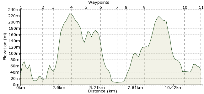
Ascent
328m (1076ft)
Descent
310m (1017ft)
Max. Elevation
230m (754ft)
Altitude Gain & Loss
638m (2093ft)
Start & End
Lochailort
Distance
12.40km
(7.71mi)
(7.71mi)
Duration
~4:30h
Difficulty
Moderate
Ordnance Survey Maps
The Ardnish peninsula is a great place to explore. Start your walk from Lochailort Station, and after a short walk along the road you are deep in the heart of a typically Scottish environment - a soggy mix of lochs, forest, bogs and beaches, and the curious ruins around Peanmeanach bothy at the far end. There's a clear path in on the northern side of the peninsula, but navigating across the southern side on the way in makes for a more varied day.
Walk Functions
Share
Nearby Walks
A walk through Lochaber
A moderate, circular walk (low hills and fells (below 600m)) starting in Highland, Scotland, about 17.20km (10.69 mi) long, duration: ~6:30h.The Corbetts of the Moidart peninsular
A moderate, circular walk (mountain (above 600m)) starting in Highland, Scotland, about 13.70km (8.51 mi) long, duration: ~6:30h.Loch Beoraid
A moderate, linear walk (low hills and fells (below 600m)) starting in Highlands, Scotland, about 21.60km (13.42 mi) long, duration: ~7:30h.Walk Map
- $walk->POI array(0)
Waypoints
OS Grid NM769826
From the station, take the track on the northern side behind the station. This takes you over the hill behind the road and railway - better than a walk along the road.
OS Grid NM753826
Head down the track to Polnish. Cross the road and drop down past the small car park to a few buildings on the loch shore. Walk past them and along the loch shore until the first stream. Here, head directly up until you reach the high ground past some trees.
About 1.59 km (~0.99 miles) from 
OS Grid NM747825
You should come out near an old ruined building/sheep fold. From here, it's map and compass time - take a bearing towards Lochan a Bhealaich. It's hidden from view, but as you reach the top of the hillock ahead, it should be visible.
About 0.61 km (~0.38 miles) from 
OS Grid NM738817
The three small lochans in the northwest corner of Ardnish provide useful navigational aids. Best to stick to the high ground, keeping them to your right. As you come towards the high point of An t-Aonach (marked on the map as 245m), head towards Loch Doire a' Ghearrain.
About 1.20 km (~0.75 miles) from 
OS Grid NM729814
At the loch, keep to the southern side and cross the very wet ground between the loch and a small copse of trees, which sit below a sharp slope. Follow the loch shore until you spot a gap in the hills to the southwest - this is your route through to Peanmeanach.
About 0.92 km (~0.57 miles) from 
OS Grid NM720809
Once through the gap, you can see the bay ahead. Pick your way down the slope until you reach the flat ground. A track (the route out) is in the middle of the flat ground, so head for this.
About 0.97 km (~0.6 miles) from 
OS Grid NM711804
The ruins here are from an old fishing village, abandoned sometime in the 20th century. It's far from abandoned now - people flock to the bothy. It's easy to see why - the bay is stunning, and some overnight visitors feast on fresh mussels picked from the sea.
About 1.03 km (~0.64 miles) from 
OS Grid NM713810
The way home is much easier to follow - pick up the track leading away from the bothy. It passes thtough some woodland and leads you along the northern side of Ardnish.
About 0.61 km (~0.38 miles) from 
OS Grid NM716821
The path heads past the western side of the loch. From here, it heads up to Cruach an Fhearainn, with good views over Loch non Uamh.
About 1.16 km (~0.72 miles) from 
OS Grid NM740832
Cross the railway at Loch Dubh and head for the road. At the road, retrace your steps to the white church at Polnish.
About 2.63 km (~1.63 miles) from 
 Polnish
OS Grid NM751829
At Polnish, follow the track back to Lochailort station. There's a friendly pub by the roadside in Lochailort for a pint if you have to wait for the station.
About 1.18 km (~0.73 miles) from 
