Harrison's Rocks from Eridge
A moderate walk (countryside) in Kent, England, about 15.10km (9.38 mi) long with an estimated walking time of about 4:30h. It is suitable for families with children, but unsuitable for prams & pushchairs, wheelchairs.
Elevation Profile
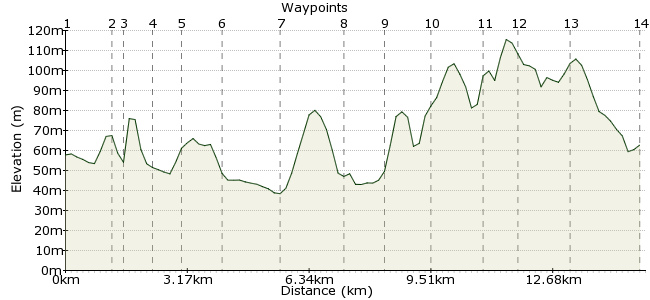
Ascent
101m (331ft)
Descent
96m (314ft)
Max. Elevation
120m (393ft)
Altitude Gain & Loss
197m (645ft)
Start & End
Eridge
Distance
15.10km
(9.38mi)
(9.38mi)
Duration
~4:30h
Difficulty
Moderate
Ordnance Survey Map
This walk circuits the sandstone crags of Harrison's Rocks, popular with climbers but good for walkers too. It's a great walk in spring when the bluebells and wild garlic are out.
For a short walk, finish at Groombridge just north of the rocks; the alternative route described here takes in more of the enjoyable High Weald countryside.
Walk Functions
Share
Nearby Walks
Exploring Ashdown Forest
A moderate, linear walk (countryside) starting in East Sussex, England, about 15.70km (9.76 mi) long, duration: ~4:45h.Broadstone Warren in Ashdown Forest
A leisurely, circular walk (woodland) starting in East Sussex, England, about 5.90km (3.67 mi) long, duration: ~2:00h.A walk of two halves
A moderate, linear walk (countryside) starting in East Sussex, England, about 18.60km (11.56 mi) long, duration: ~6:00h.Walk Map
- $walk->POI array(0)
Waypoints
OS Grid TQ542345
Start the walk in Eridge.
OS Grid TQ531351
Walk along the road to Forge Farm.
About 1.29 km (~0.8 miles) from 
OS Grid TQ532353
Enter the woodland where on a sunny day you will find climbers on the sandstone routes.
About 0.30 km (~0.19 miles) from 
OS Grid TQ530359
Follow the footpath around the rocks.
About 0.64 km (~0.4 miles) from 
OS Grid TQ531367
The path takes you to Groombridge; catch the train here for a shorter day out.
About 0.76 km (~0.47 miles) from 
OS Grid TQ520367
Otherwise, continue along the path south of Groombridge
About 1.08 km (~0.67 miles) from 
OS Grid TQ507372
At Hale Court Farm, take the left fork along the Sussex Border Path.
About 1.48 km (~0.92 miles) from 
OS Grid TQ492365
Beyond Summerford, the path bears south towards Withyham.
About 1.64 km (~1.02 miles) from 
OS Grid TQ492356
Pass through Withyham, with a pint at the Dorset Arms: www.dorsetarms.co.uk/aboutus.html
About 0.98 km (~0.61 miles) from 
OS Grid TQ502349
Pick up the path again, heading southeast to Buckhurst Park,
About 1.15 km (~0.71 miles) from 
OS Grid TQ506337
Either follow the path to Littlebrook, or take the short cut through the woods to Lye Green.
About 1.32 km (~0.82 miles) from 
OS Grid TQ512338
Pick up the High Weald Path - a lot of long distance paths round these parts - and head for Penns in the Rocks.
About 0.71 km (~0.44 miles) from 
OS Grid TQ523347
Pass Penns in the Rocks and continue east back towards Eridge.
About 1.38 km (~0.86 miles) from 
 Eridge
OS Grid TQ541344
Finish up at Eridge station; the Huntsman pub is a good spot if you want another snifter before heading home: http://thehuntsmanpub.com
About 1.85 km (~1.15 miles) from 
